Art gallery: Creating art to spark conversations about sea level change in Alaska

Hello! My name is Kate Lochridge, and I am a marine biology and fine art dual major from Bowling Green, Ohio. One of the best parts of science is sharing it with the community. One way to do that is by using fine art to help new audiences access and understand topics they would not otherwise be exposed to.

Kate and Nicole stand together with one arm around each other. They are smiling and standing next to a display of paintings, which are nested inside of a 1 meter by 1 meter square made of pvc (a sampling quadrat).

Kate and her mentor, Nicole Kinsman, Ph.D., standing in front of Kate’s “Isostatic rebound” module. (Image credit: Nic Kinsman/National Geodetic Survey)

This is so important to me that the purpose of my internship was to use fine art to translate information from scientific reports, site visits, interviews with scientists and artists, and plein air observations (creating art while directly observing the environment) to encourage public discussion about sea level change in Southcentral Alaska.

My Hollings artist-in-residence experience at Kasitsna Bay Laboratory and with the Kachemak Bay National Estuarine Research Reserve resulted in an exhibit with multiple elements: a sketch journal and four sets of thematically grouped paintings that focused on the process of collecting data, illuminating ecosystem adaptation, the impact of earthquakes on local sea level, and creative education strategies. The collection was displayed at a free two-hour art show that was open to the Homer, Alaska, community, and it was attended by more than 85 people.

Getting to work with Kate ... and the whole network she built during her internship opened my eyes even more to the importance of including the fine arts in science. The discussion I was seeing happening at her final shows were like little sparks in the air - you could almost see them and definitely feel them.

Nicole Kinsman, Ph.D., National Geodetic Survey, Internship mentor to Kate Lochridge

Tour Kate's art show

This panorama shows the setup of Kate's art show. You can view a few paintings from each module of Kate's show below the panorama. The show consisted of four modules, each of which address a topic related to sea level change in southcentral Alaska. From left to right: “Impacts on ecosystems,” “Behind-the-scenes of data collection and production,” “Rapid vertical land movement,” “Novel methods of communication on glacial melt.”

A panorama of Kate's work grouped in modules. Module one: several small paintings are arranged within a sampling quadrat, Module two: a large painting of rising data curve with a woman looking at a computer painting slightly overtop it is surrounded by four smaller paintings. Module three: two paintings atop wooden frames stood up on a table. Module four: another table holds several paintings and a notebook.
This panoramic photograph shows the setup of Kate's art show. (Nic Kinsman/National Geodetic Survey)

Impacts on ecosystems: Isostatic rebound

In coastal marshes, isostatic rebound can cause shifts in salt water extent and salt water concentration. Isostatic rebound occurs when glaciers retreat and the land, freshly unburdened by the weight of the ice, lifts up. The paintings in this module reference photographs taken by scientists at the Kachemak Bay NERR who research coastal marsh plant communities, which change in response to shifts in the boundary between fresh and salt water.
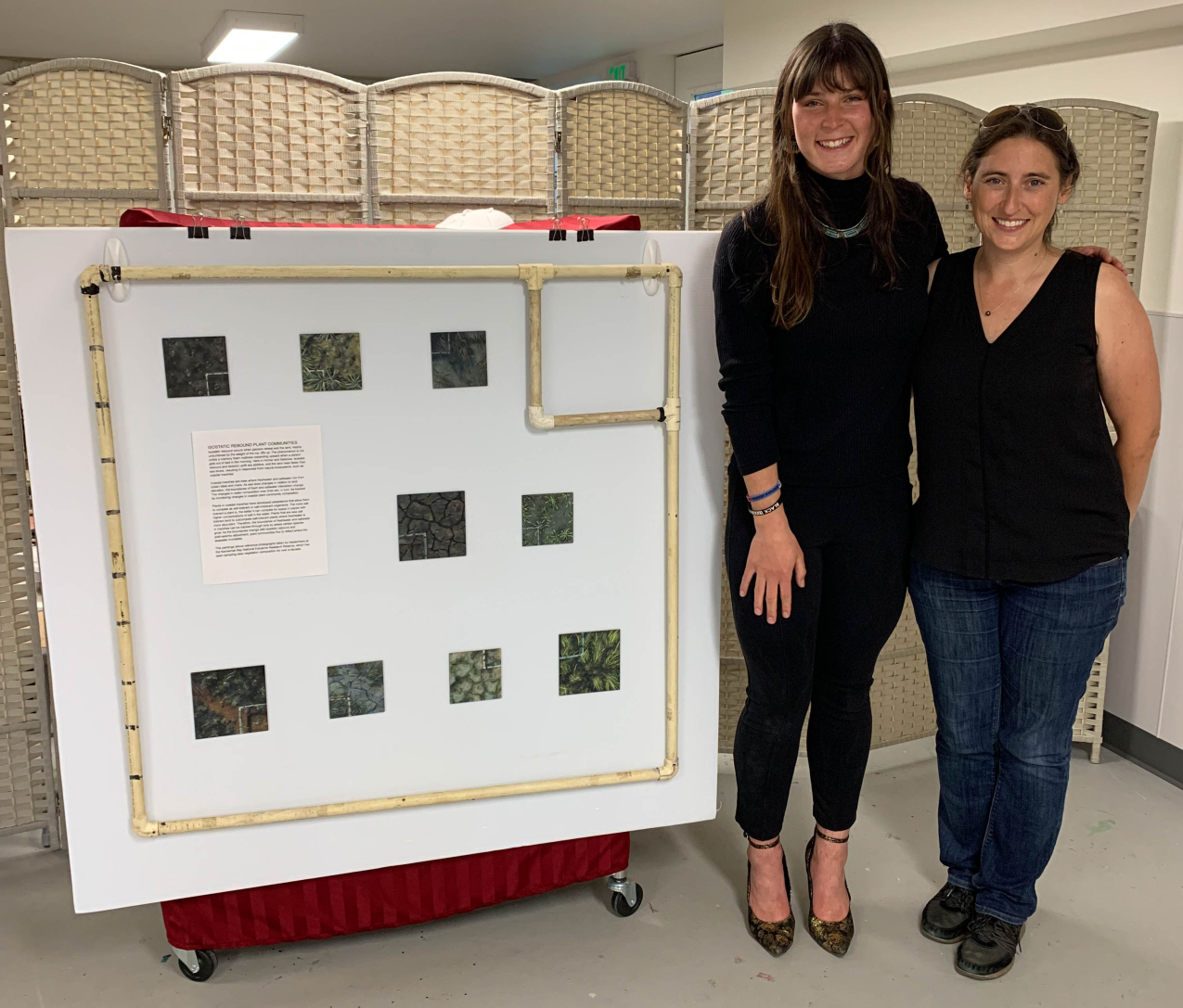
Kate and Nicole stand together with one arm around each other. They are smiling and standing next to a display of paintings, which are nested inside of a 1 meter by 1 meter square made of pvc (a sampling quadrat).
Kate and her mentor, Nicole Kinsman, Ph.D., standing in front of Kate’s “Isostatic rebound” module. (Nic Kinsman/National Geodetic Survey)

Behind-the-scenes of data collection and production

In Southcentral Alaska, the land is uplifting faster than the ocean is rising, resulting in decreasing sea levels in the region (relative sea level change), even as the ocean level rises globally. Scientists predict that as the rate of sea level rise accelerates under future climate change scenarios, it will eventually catch up with, and surpass, vertical land movement in Southcentral Alaska. Regional planners need projections of future relative sea level rise to build resiliently, and creating such projections requires scientists to collect large amounts of data. The paintings in this module illuminate the data collection and processing needed to provide sea level rise projections to the public.

See the 2022 sea level rise technical report, which includes the information discussed above.

The paintings in this module were based on source images taken by NOAA contractor JOA Surveys LLC. 

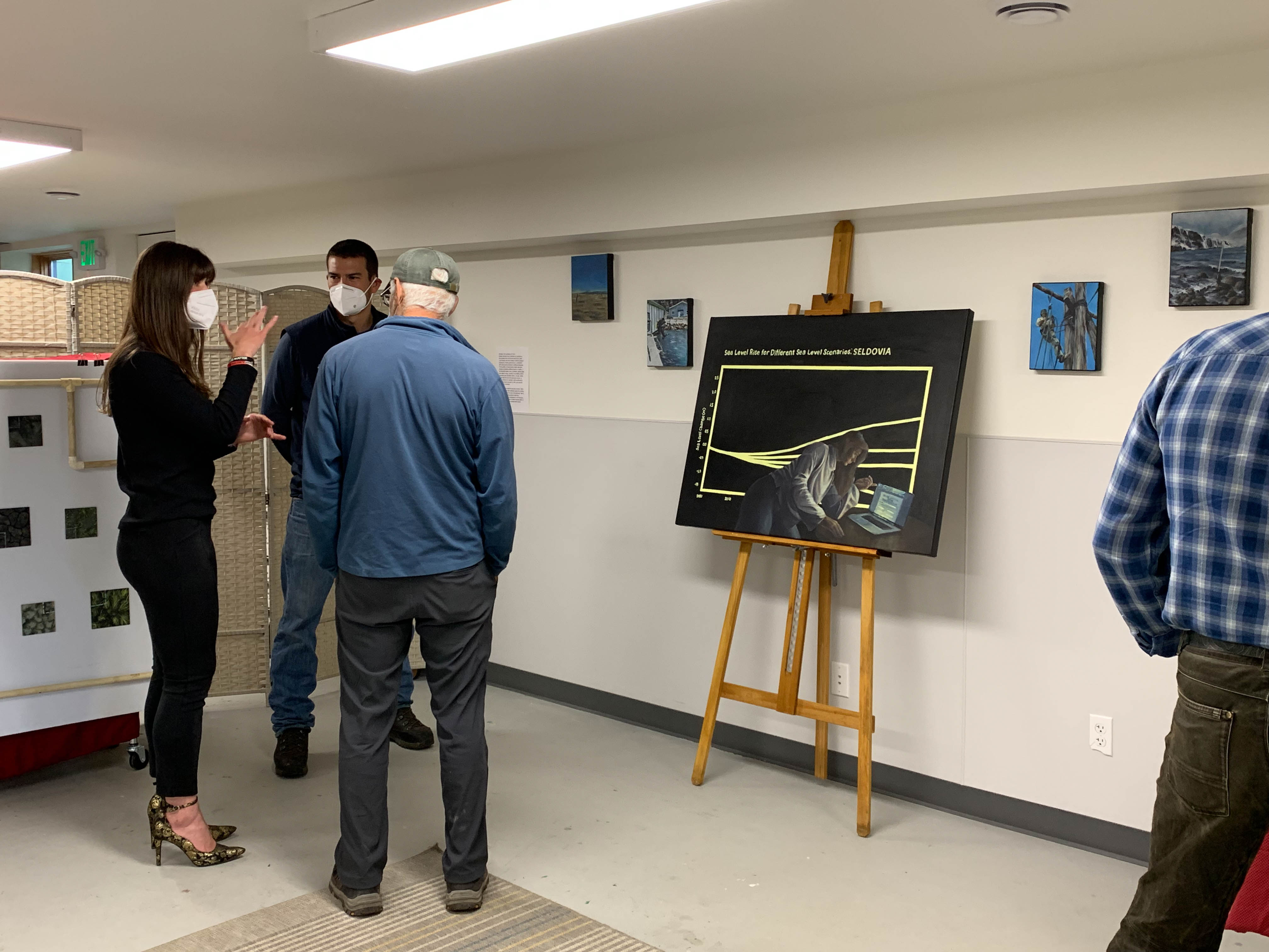
A large painting with two smaller paintings on the wall on either side. The large painting is a data line graph of rising sea level with the title "Sea Level Rise for Different Sea Level Scenarios: Seldovia. A painting of a woman working at a computer is overlaid on the painting of the graph. She appears to be working in coding software on the computer screen.
Kate's module on data collection and production featured paintings of scientists at work, sampling tools, and data processing and display. (Nic Kinsman/National Geodetic Survey)
The painting shows a person in a rain slicker holding a staff over twice their height and standing on coastal rocks that are surrounded by choppy water. In the background of the painting is a landscape of snowy mountains and an overcast sky.
Kate's painting of a JOA Surveys, LLC. employee taking manual tidal measurements with a staff. The reference photo was taken at the Akun Bay tide station. (Painting: Kate Lochridge, Reference photo: JOA Surveys, LLC.)
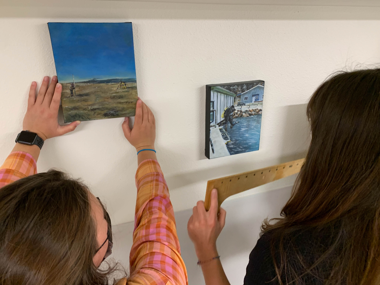
Kate holds a ruler as her sister places a painting. The left painting shows someone holding a pole that extends several feet above them while another person looks through a surveying tripod in a coastal area. The second painting shows a scuba diver mid-jump from a boat docked near the shore.
Kate and her sister, Annie, placing paintings in the Data collection and production module. The paintings show surveyors taking tidal measurements (left) and a scuba diver going to check a tidal gauge (right). (Nic Kinsman/National Geodetic Survey)
Kate is captured mid-gesture as she talks to two people at her art show.
Kate discusses Seldovia, Alaska sea level trends with JOA Surveys, LLC employee Nathan Wardwell and his father in-law. (Nic Kinsman/National Geodetic Survey)

Rapid vertical land movement

Some vertical land movement that affects relative sea level changes takes place over centuries, while other movement caused by seismic events, such as Alaska's infamous 1964 earthquake, can happen in a matter of minutes. Here, Kate shows how sinking of the ground (subsidence) associated with the 1964 earthquake dropped portions of the town of Seldovia, Alaska, below local mean sea level, resulting in coastal flooding and highlighting the highly variable nature of sea level trends in areas that experience rapid vertical land motion.
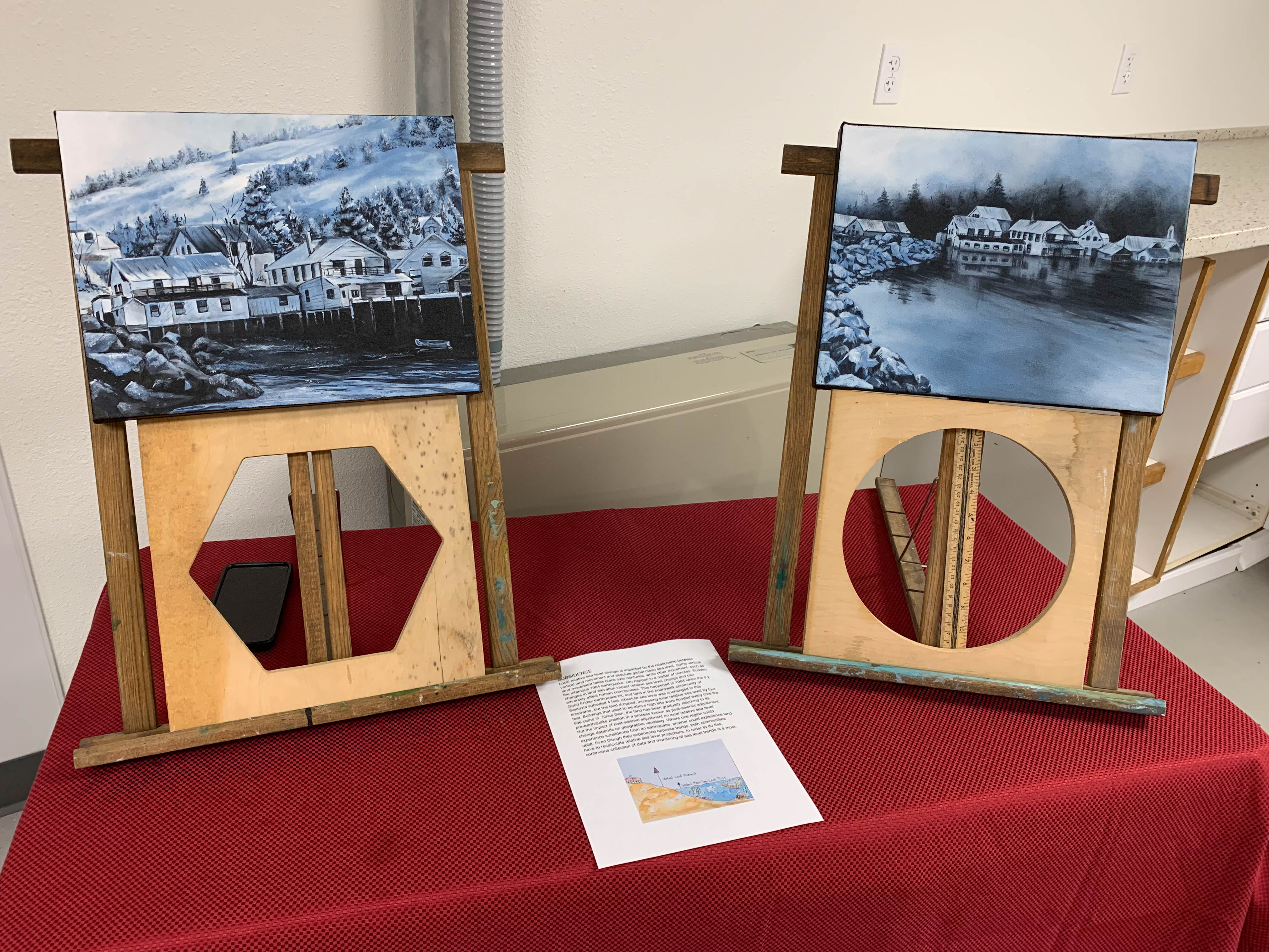
Two paintings displayed on a table. On the left is a snowy coastal town with a mountainous landscape behind it.  The painting rests on a wooden frame with a cut out hexagon. The right painting shows the same town from a more distant location, but the coastal waters now flood the town by what appears to be a few feet above the elevated frames that many houses rested on. The painting is on a wooden frame with a circle cutout and a ruler in the circular opening.
What at first appears to be a display of two paintings of a scenic landscape tells a story about sea level change after a 9.2 magnitude earthquake caused land to subside 4 feet, which dropped the town of Seldovia, Alaska, below high tide. On the left is Seldovia before the 1964 earthquake. On the right is Seldovia flooded by high tide after the 1964 earthquake. (Nic Kinsman/National Geodetic Survey)


Novel methods of communication on glacial melt

This module featured a painting and Kate's sketchbook. The painting shows fellow Hollings summer interns standing near a marker that showed the extent of the Exit glacier in the year 1899 along a trail where visitors can hike and learn about glacial retreat and ecological responses. While working on her sketchbook, Kate spoke to many people about her work and the scientific processes she saw reflected in the surroundings that she illustrated.
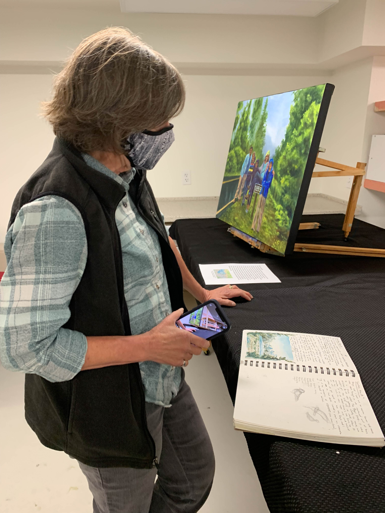
A woman wearing a fabric face mask over her mouth and nose looks at an open sketch book, which contains a watercolor painting and handwritten notes. Behind her, there is a painting of a group of people standing alongside the road next to a sign that reads "1899"
This module features a painting of tourists at a marker for the extent of the Exit glacier in the year 1899 and Kate's sketchbook. Kate’s mentor, Kris Holderied, looking through the sketchbook. (Nic Kinsman/National Geodetic Survey)
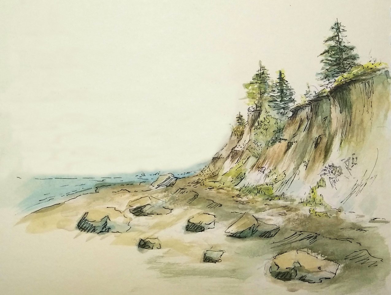
An eroded coastal cliffside with large rocks scattered at its base. A few conifers and shrubs hugs the top of the cliff. The painting evokes a sense of downward movement along the cliff towards calm water.
Watercolor study of bluff erosion past Bishop’s Beach, Homer, Alaska. Bluff erosion is an issue for long-term community planning, but establishing and maintaining long-term data sets will help communities design resilient building plans. (Kate Lochridge)
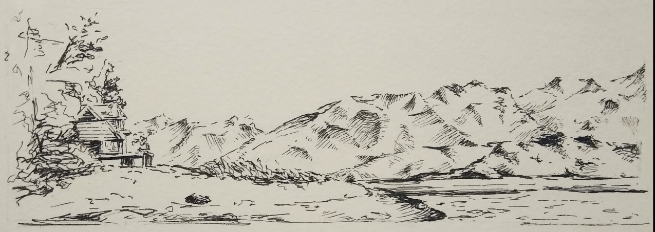
A pen sketch of a raised coastal home nested in trees and vegetation. Mountains extend beyond the house and alongside the coastal waters.
Pen and ink plein air study of a coastal property in Homer, Alaska. (Kate Lochridge)
A mountain range against a red watercolor sky. The mountains are painted in greens, blues, oranges, and reds.
Plein air watercolor study of mountains across the bay from Homer, Alaska. (Kate Lochridge)
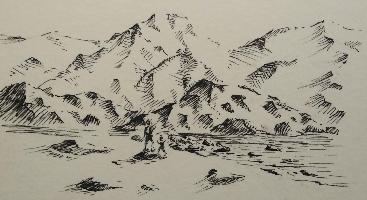
An ink sketch of a rocky beach and mountains in the background. Two people are on the beach, small next to the mountains. The childlike figure appears to be running with arms up, while an adult figure stands on a rock next to the child and looks towards the mountains.
Plein air study of people visiting Bishop’s Beach in Homer, Alaska. I wanted to capture how evident their enthusiasm was, even from hundreds of feet away. (Kate Lochridge)
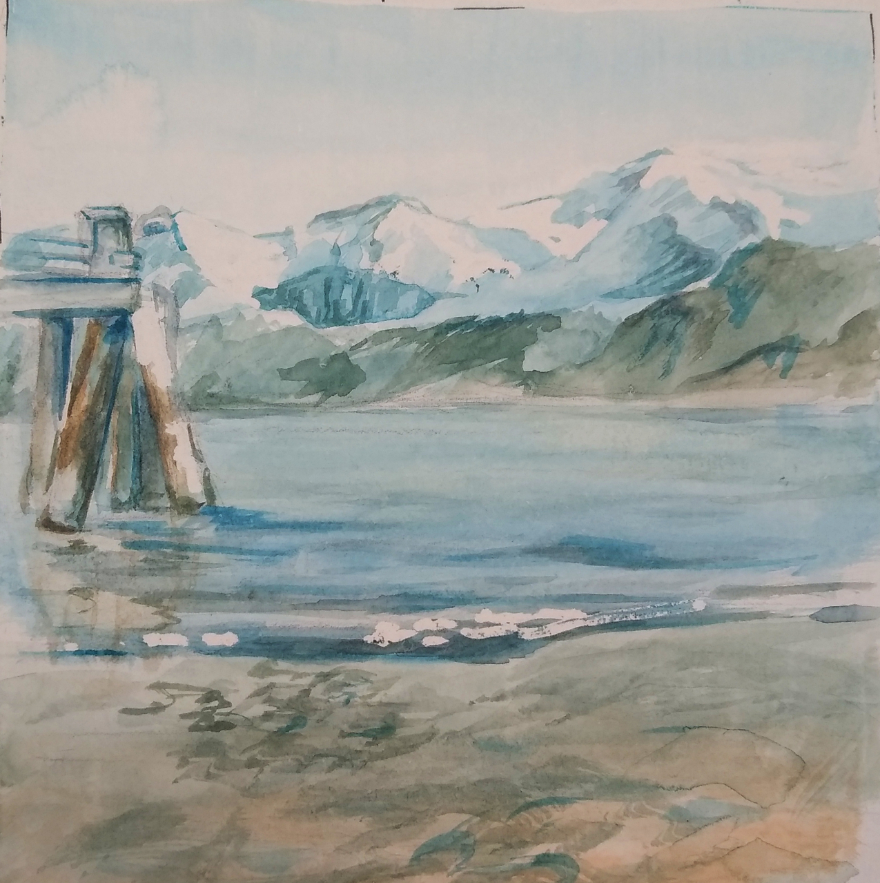
A calm watercolor painting of coastal waters with a mountain range in the background. The water is painted calmly, with a gentle tide.
Study of piling with tidal instruments in Homer, Alaska. (Kate Lochridge)
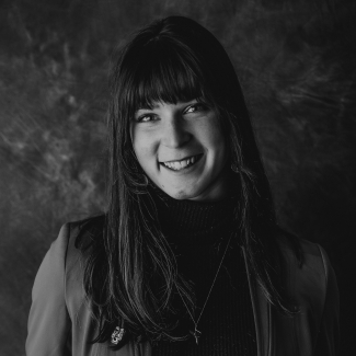
A black and white professional photo of Kate Lochridge
Kate Lochridge, 2021 Hollings scholar

Kate Lochridge is a marine biology and fine art double major at Bowling Green State University offsite link.