• Home
  • Weather
  • Climate
  • Ocean & Coasts
  • Fisheries
  • Satellites
  • Research
  • Marine & Aviation
  • Charting
  • Sanctuaries
  • Education
  • News and features
  • Tools & resources
  • About our agency
U.S. flag

An official website of the United States government

Dot gov

Official websites use .gov
A .gov website belongs to an official government organization in the United States.

SSL

Secure .gov websites use HTTPS
A lock ( lock icon ) or https:// means you’ve safely connected to the .gov website. Share sensitive information only on official, secure websites..

Find your local weather
Change location:
  • News
  • Tools
  • About
 
 
NOAA mobile logo
NOAA logo National Oceanic and Atmospheric Administration U.S. Department of Commerce


Topic: Satellite data

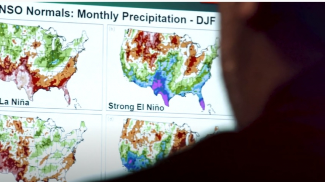
NOAA physical scientist Anthony Arguez reviews El Niño and La Niña winter precipitation Climate Normals on a computer screen at NOAA's National Centers for Environmental Information.
AI agreement to enhance environmental monitoring, weather prediction
October 27, 2020
Focus areas:
Satellites
Topics:
satellite data
artificial intelligence
partnerships
NOAA physical scientist Anthony Arguez reviews El Niño and La Niña winter precipitation Climate Normals on a computer screen at NOAA's National Centers for Environmental Information.
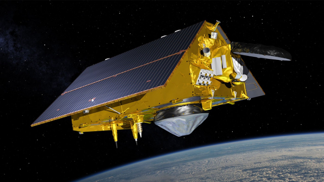
Artist rendering of the Sentinel-6 Michael Freilich satellite
Upcoming satellite mission will improve hurricane forecasts and climate science
August 14, 2020
Focus areas:
Satellites
Topics:
hurricanes
satellite data
climate data
Artist rendering of the Sentinel-6 Michael Freilich satellite
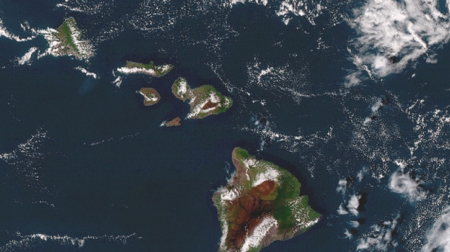
The Hawaiian Islands seen from NOAA's GOES-17 satellite on November 13, 2018. GOES-17 is among NOAA’s next generation of advanced geostationary weather satellites. The spacecraft provides high-quality data coverage of the Pacific Ocean.
3 ways satellites connect scientists with ocean life
June 29, 2020
Focus areas:
Fisheries
Satellites
Topics:
satellite data
fisheries
ocean
The Hawaiian Islands seen from NOAA's GOES-17 satellite on November 13, 2018. GOES-17 is among NOAA’s next generation of advanced geostationary weather satellites. The spacecraft provides high-quality data coverage of the Pacific Ocean.
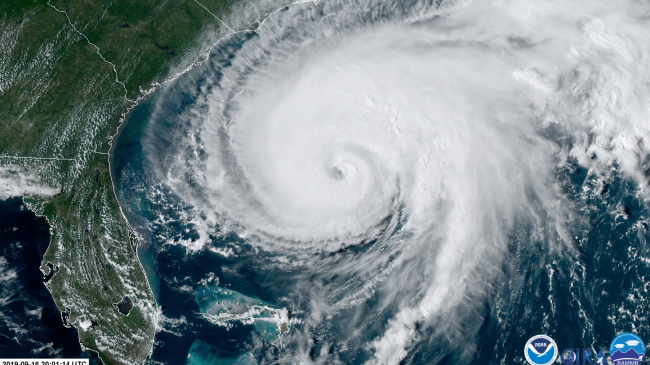
Hurricane Humberto as seen from NOAA’s GOES-East satellite on Sept. 15, 2019.
NOAA harnessing the power of new satellite data this hurricane season
June 1, 2020
Focus areas:
Satellites
Weather
Topics:
satellite data
hurricane season
forecasting
Hurricane Humberto as seen from NOAA’s GOES-East satellite on Sept. 15, 2019.
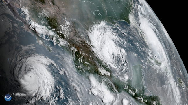
A view from GOES-17 of three tropical systems in the eastern Pacific and Atlantic basins in September 3, 2019. From left to right: Hurricane Juliette, Tropical Depression 7 and Hurricane Dorian.
Billion-dollar disasters show crucial link between NOAA satellites and emergency managers
February 7, 2020
Focus areas:
Climate
Satellites
Topics:
Billion-Dollar Disasters
satellite data
A view from GOES-17 of three tropical systems in the eastern Pacific and Atlantic basins in September 3, 2019. From left to right: Hurricane Juliette, Tropical Depression 7 and Hurricane Dorian.
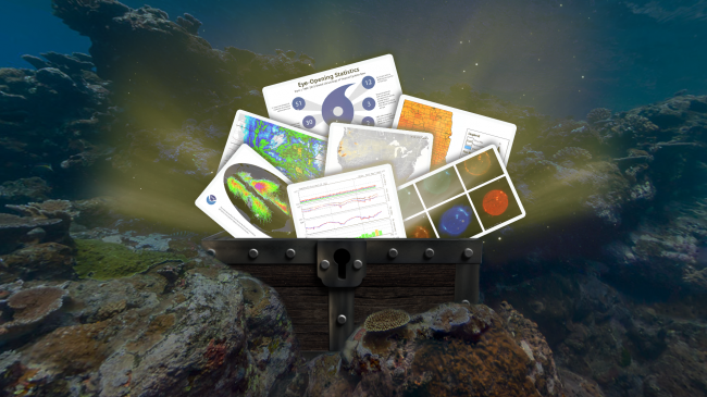
NOAA data are freely available to anyone who wants to learn about the world and its many scientific mysteries. Find out more about our online data tools and resources. #NOAADataFest
Dive into NOAA's treasure trove of data
October 8, 2019
Focus areas:
Satellites
Topics:
satellite data
climate data
NOAA data are freely available to anyone who wants to learn about the world and its many scientific mysteries. Find out more about our online data tools and resources. #NOAADataFest
Satellite sea-surface temperature data from off of the U.S. West Coast, comparing September 2014 versus September 2019.
Marine heat wave reminiscent of 'the Blob' lingers off U.S. West Coast
October 8, 2019
Focus areas:
Satellites
Topics:
heat waves
ocean
satellite data
Satellite sea-surface temperature data from off of the U.S. West Coast, comparing September 2014 versus September 2019.
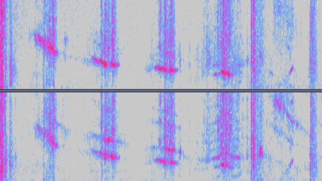
GOES sonification of solar activity.
The sound of science: Students identify solar storm from audio of satellite data
October 18, 2018
Focus areas:
Climate
Topics:
citizen science
satellite data
GOES sonification of solar activity.
Subscribe to satellite data
Back to top
NOAA Home
Science. Service. Stewardship.
  • News
  • Tools
  • About
  • Protecting Your Privacy
  • FOIA
  • Information Quality
  • Accessibility
  • Guidance
  • Budget & Performance
  • Disclaimer
  • EEO
  • No-Fear Act
  • USA.gov
  • Ready.gov
  • Employee Check-In
  • Staff Directory
  • Contact Us
  • Need Help?
  • COVID-19 hub for NOAA personnel offsite link
Stay connected to NOAA
NOAA on Twitter NOAA on Facebook NOAA on Instagram NOAA on YouTube
How are we doing?
Feedback opens in new window