




Discover history with NOAA's Heritage Program

NOAA has a long history, dating back to 1807 with the founding of the Survey of the Coast. That means there’s a lot of historic gems laying around the “attic,” such as old scientific equipment, photos, and documents. On Fridays, NOAA’s Heritage staff will post interesting finds as we sift through NOAA's past. Maybe it’s a cool photo that hasn’t been seen in a while, or perhaps it’s a recently discovered item retrieved from a forgotten corner. Enjoy!
Discover NOAA’s Friday Finds below.

These Engineering Development Units (EDUs) were used to test the functioning of the High Resolution Infrared Radiation Sounder (HIRS/4) and Advanced Very High Resolution imaging Radiometer (AVHRR/3) instruments on Polar-orbiting Operational Environmental Satellites (POES) before and after they were sent into orbit.
2025 Finds

The Roberts radio current meter was the first moored system to automatically record and transmit ocean current data. It was used by one of NOAA’s predecessor agencies, the U.S. Coast and Geodetic Survey.

Among its many responsibilities, the U.S. Coast and Geodetic Survey was charged with observations of the earth's magnetic field. One of the instruments used for these measurements was this cosmic-ray meter, which detected the arrival of atomic particles from interstellar space at Earth’s surface.

This copper plate printing press was in operation by the U.S. Coast Survey, the Environmental Science Services Administration, and then NOAA, from 1851 through 1976.

This sign originally marked the entrance to NOAA’s Research Flight Facility at Miami International Airport in Florida.

This vinyl record was found for sale at a record shop in Washington, D.C., in 2024. To an audiophile, the label might seem curious at first: “Winter Storms” could plausibly be the title of an old jazz or heavy metal record. The black cardboard sleeve is enigmatic and intriguing, with corners worn from years of use.
2024 Finds

This is a buoy from the Deep-ocean Assessment and Reporting of Tsunamis (DART®) system, which can detect tsunamis as small as 1 cm and report them in real time.

Clarence E. Pete Petersen was a chief boatswain in the U.S. Coast and Geodetic Survey and an avid cartoonist. This cartoon he created shows a humorous scene from a 1938 survey of Glacier Bay, Alaska.

The U.S. Coast and Geodetic Survey (NOAA’s predecessor agency) used this style of automatic tide gauge to record water levels until the 1960s.

Visitors to NOAA’s Air Resources Laboratory Atmospheric Turbulence and Diffusion Division in Oak Ridge, Tennessee, may notice a toy bear perched high on a shelf in the hallway. That small, stuffed bear wearing a gas mask and kerchief tells a story about one of NOAA’s research achievements in air quality.

In 1957, the country celebrated the 150th anniversary of the U.S. Coast and Geodetic Survey (USC&GS) by printing stamps featuring the USC&GS flag and three ships.

Marine chronometers are precise, portable timekeeping instruments used to determine a ship's position at sea. This particular clock was used on U.S. Coast and Geodetic Survey ships in the 1940s.

On June 28, 1969, the temperature reached record highs in parts of New York City, and the Stonewall Uprising in defense of LGBTQ+ rights began at the Stonewall Inn in Greenwich Village, NYC. These weather logs tell the story.

This beautiful painting of the USC&GS Steamer Oceanographer was painted by Robert Foster, who served aboard the Oceanographer around 1932 to 1936. It came into the hands of his fellow crew member, Lyman M. Rundlett, and was donated to NOAA by Rundlett’s son, James Rundlett.

This record from the late 1960s contains tornado safety announcements from NOAA’s predecessor agency, the Environmental Science Services Agency (ESSA).

In the early 1980s if you found yourself close to a tornado, you might have reached for one of these small tip cards. Before websites and social media were invented, one of these could go right into your wallet, next to your library card, your driver’s license and photos of your family – always there when you needed them.
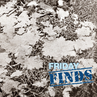
On the morning of February 28, 1936, “ice crystals of unusual size” were found in Boise, Idaho.
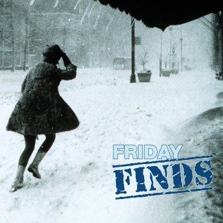
The snowy season is upon us, so we’re sharing a few historic photos from our archives of some amazing snowfalls. Make sure to check out the last one and help us solve a mystery!
2023 Finds
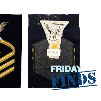
Until the late 1960s, enlisted members of the U.S. Coast & Geodetic Survey (USC&GS) wore rating badges to denote their rate (or rank) and specialty.
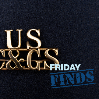
This insignia pin was worn on caps by U.S. Coast and Geodetic Survey cooks and stewards from around 1941 to1963.
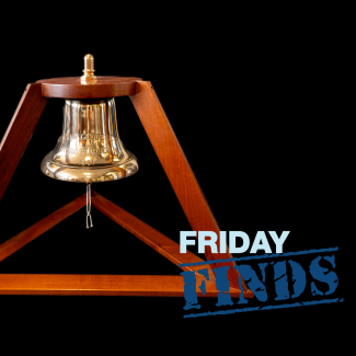
It’s 1931 and you are a U.S. Coast and Geodetic Survey Corps officer on the USC&GSS Hydrographer. A bell clangs urgently, waking you from sleep. What could it mean?
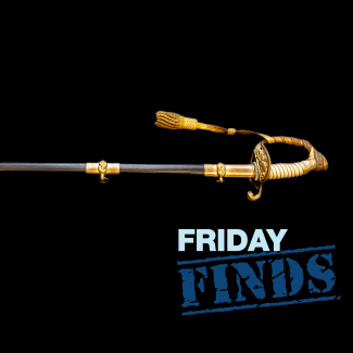
This early 20th century naval ceremonial sword belonged to Captain Nicholas H. Heck, an officer of the U.S. Coast and Geodetic Survey (USC&GS) and US Naval Reserve Force whose work revolutionized hydrographic surveying.
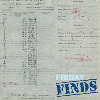
George Washington Carver is most famous for his expertise in agricultural science and his many inventions, but he was also interested in weather.
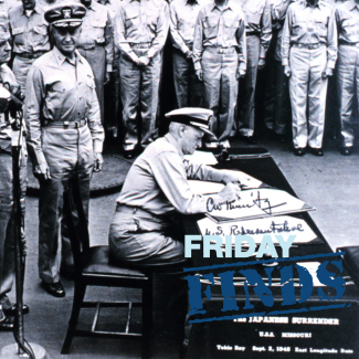
The scene below is well-known worldwide. On September 2, 1945, representatives from nine Allied nations and Japan gathered on the deck of the USS Missouri to sign an Instrument of Surrender, officially ending World War II.
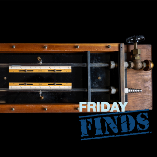
Calling all extreme ocean buffs and seafarers! The NOAA Heritage Program needs your help. Email us at heritage.program@noaa.gov if you have information on this instrument!
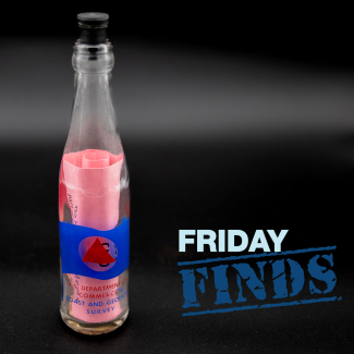
Drift bottles have become poetic symbols of loneliness: A desperate person writes an open letter to the world, closes it up into a bottle, and tosses it into the sea in the hopes of making a connection or being found and rescued from their shipwreck on a distant island. But they were once important scientific tools.
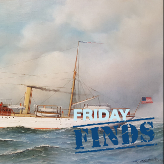
The Pathfinder was built to meet a specific need. Gold had been discovered in Alaska, causing a demand for safe shipping routes through the Bering Sea. The new research vessel was tricked out with all of the most important survey research tools of its time and designed to withstand harsh winters when it left port in Elizabethtown, New Jersey, headed for the North Pacific in 1899.
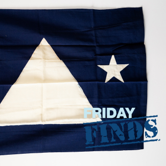
This flag flew on the U.S. Coast and Geodetic Survey (USC&GS) Ship Wainwright during World War II when the USC&GS Director Rear Admiral Lee Otis Colbert was on board.
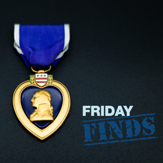
On September 11, 1942, during World War II, the U.S. Coast Guard Cutter Muskeget disappeared. The entire crew, including four young weather observers from the U.S. Weather Bureau, the predecessor of NOAA’s National Weather Service, was lost. It was decades before the U.S. military discovered what happened to them and their shipmates.
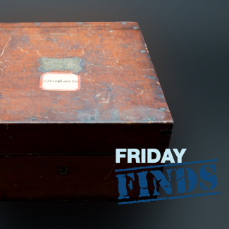
This instrument in NOAA’s heritage collection is a barocyclonometer that may have been used by U.S. Coast & Geodetic Survey ships in the Philippines in the early 20th century to detect typhoons.

“Surely the birds don’t detract from the sketch. Anacapa Island couldn’t look as blank as that map did before I added the birds.” - James McNeill Whistler
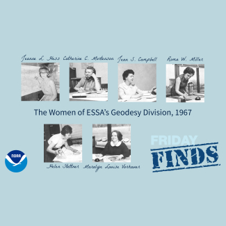
“Would you believe forty-four men and six women and no problems?” — 1967 ESSA World article, “Six lady geodesists prove that no place, but no place is no place for a woman”
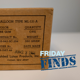
Calling all students of history! The NOAA Heritage Program needs your help. NOAA has a box labeled “BALLOON TYPE ML-131-A” from June 23, 1944. Our inaugural “Friday Finds” mission is to figure out what it is and how it was used. Email us at heritage.program@noaa.gov if you know!