April is Citizen Science Month! In celebration, we will be highlighting one citizen science project from NOAA and our partners from now until Earth Day on April 22.
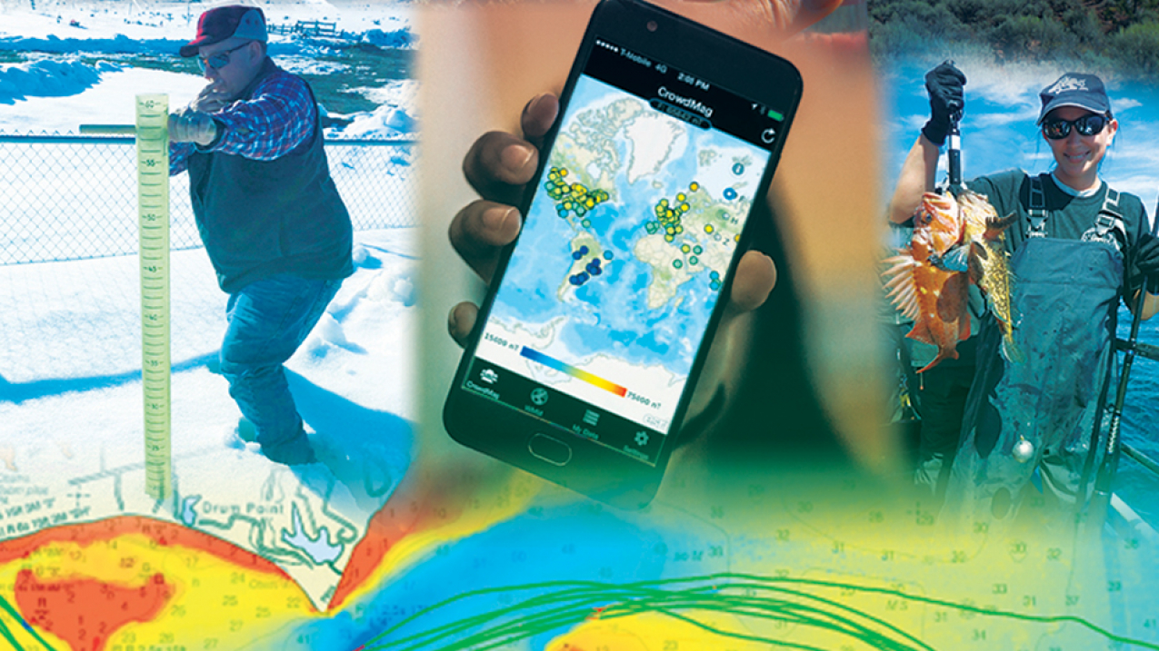
NOAA engages the public in support of key mission areas through the rapidly growing field of citizen science — a form of open collaboration in which individuals and organizations participate voluntarily in the scientific process. Citizen scientists take part in a range of activities from observing precipitation type and amount to helping map the ocean floor. (Image credit: NOAA)
Whether trekking out to local beaches to count horseshoe crabs under a full moon or measuring Earth’s magnetic field from a smartphone, citizen scientists support NOAA’s mission while learning more about the world around them.
Check back daily Monday through Friday for new projects that you can explore! You can also follow the countdown on social media — we're @NOAAeducation on Facebook, Twitter, and Instagram.
Jump to:
#15 Spot severe weather with NOAA NWS SKYWARN®
#14 Monitor horseshoe crabs with the Florida Horseshoe Crab Watch
#13 Record historic marine weather observations with the Old Weather WWII project
#12 Collect fishery sustainability data with the California Collaborative Fisheries Research Program
#11 Catch and release eels with the Hudson River Eels project
#10 Record marine mammal sightings with the Channel Islands Naturalist Corps
#9 Track historic fish counts with FISHstory
#8 Monitor rain, hail, and snow with CoCoRaHS
#7 Collect Earth's magnetic data with the CrowdMag project
#6 Record temperatures in your neighborhood with the Urban Heat Island Mapping project
#5 Count fish on an underwater camera with the River Herring project
#4 Annotate underwater images with OceanEYEs
#3 Track marine pollution with the Marine Debris Monitoring and Assessment Project
#2 Save the scallops with Scallop Sitters in Hernando County
#1 Monitor environmental observations with GLOBE
Looking for more? You can search the Federal Crowdsourcing and Citizen Science Catalog for projects that interest you.
#1 Monitor environmental observations with GLOBE
April 22, 2021
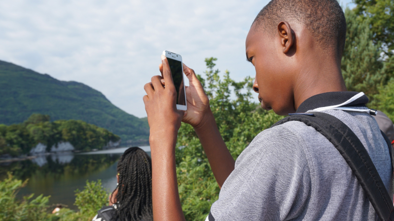
Join us in wishing a happy 26th anniversary to the Global Learning and Observations to Benefit the Environment (GLOBE) Program today! GLOBE is an international science and education program that engages students and the public in contributing meaningfully to our understanding of the Earth system. Help take important environmental observations — from cloud identification to land cover data — that researchers can use to better understand, sustain, and improve Earth’s environment! Visit GLOBE’s Get Started page and join this worldwide community.
NASA sponsors GLOBE with support from the National Science Foundation, NOAA, and the Department of State. There are 125 countries in the GLOBE family, and around 3 to 4 million students have benefited from the program. The GLOBE Observer app, introduced in 2016, has almost 200,000 registered users. Together, participants have reported nearly 200 million Earth science observations!
#2 Save the scallops with Scallop Sitters in Hernando County
April 21, 2021
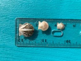
Kicked off in June 2020, the Scallop Sitters in Hernando County offsite link project is one of the newest to join the NOAA citizen science catalog. With the importance of the recreational bay scallop fishery on the Gulf coast of Florida, the Scallop Sitters program created by the University of Florida was a response to a regional decrease in annual scallop abundance. Trained volunteers use wild caught bay scallops and place them in predator exclusion cages to help boost local scallop populations. Visit the Scallop Sitters in Hernando County project page offsite link to learn more and sign up to join their efforts!
#3 Track marine pollution with the Marine Debris Monitoring and Assessment Project
April 20, 2021
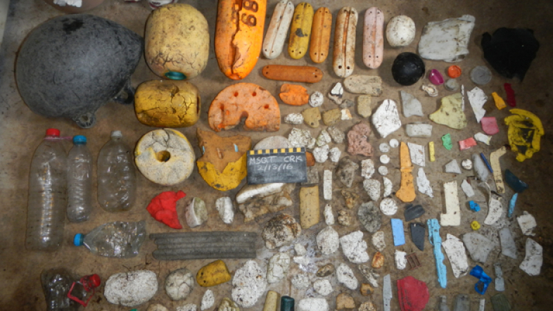
Tackling the global problem of marine debris pollution in our Ocean and Great Lakes is the mission of the Marine Debris Monitoring and Assessment Project. By using simple procedures and engaging partners and citizen science volunteers, the Marine Debris Monitoring and Assessment Project is able to track the amount and types of debris on our shorelines. The data they collect can help assess the progress of existing marine debris prevention initiatives and identify targets for future efforts. Check out the Marine Debris Monitoring and Assessment Project Get Started Toolbox to learn more.
#4 Annotate underwater images with OceanEYEs
April 19, 2021
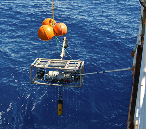
NOAA’s Pacific Islands Fisheries Science Center conducts resource surveys and stock assessments to provide the best scientific information to inform management of bottomfish known as the "Hawaiʻi Deep 7," which consists of six species of snapper and one species of grouper. The annual bottomfish survey includes camera systems that sit near the seafloor and capture hundreds of thousands of images. With the help of citizen scientists, the OceanEYEs offsite link project uses volunteers to annotate these images by locating, counting, and identifying fish in the images. Each volunteer that contributes to OceanEYEs helps to train NOAA’s machine algorithms and improves the data for these economically and culturally important fish in the Hawaiian Islands.
#5 Count fish on an underwater camera with the River Herring project
April 16, 2021
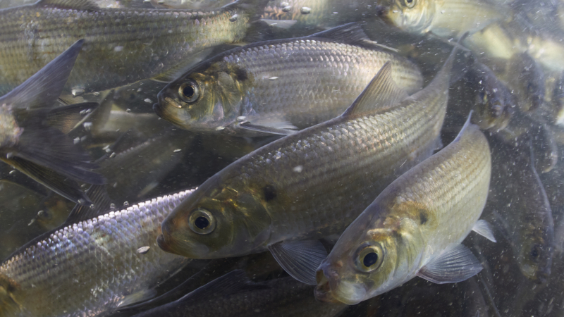
For hundreds of years, several dams have blocked the passage of river herring in the Town Brook stream in Massachusetts. The dams limited the fish from migrating upstream and caused populations to decline. Since 2002 several of the dams have been removed and the citizen science project River Herring offsite link started training volunteers to count the migrating fish annually in person from April to June. In 2019, the project installed underwater cameras offsite link which offers volunteers from across the country to take part in the annual river herring counts. Simply read a short set of instructions offsite link and you can start counting the fish as they swim past the camera!
#6 Record temperatures in your neighborhood with the Urban Heat Island Mapping project
April 15, 2021
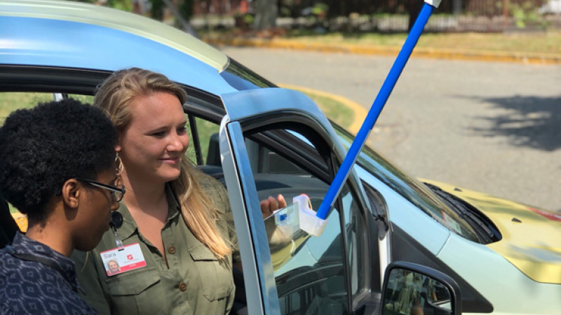
With summer quickly approaching, look no further than the Urban Heat Island project to monitor heat in your city. With specially designed sensors mounted on their cars, volunteers drive pre-planned routes three times a day to record temperature, humidity, and their exact location every second! The project aims to create detailed maps of urban heat islands in cities like Honolulu, Houston, and Raleigh. The maps created by the Urban Heat Island project are shared with local residents and city officials so that they can consider how to manage the risks associated with exposure to extreme heat.
#7 Collect Earth's magnetic data with the CrowdMag project
April 14, 2021
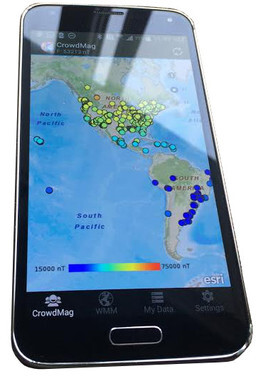
Did you know that you can participate in NOAA citizen science just by being outside? The CrowdMag project utilizes mobile apps that collect magnetic data from digital magnetometers that are built in modern mobile smartphones. The project aims to create near-real-time models of Earth's magnetic field and magnetic navigation by filling in data gaps with existing technologies that capitalize on citizen science. Download the app today and share your magnetic data from across the United States with NOAA scientists!
#8 Monitor rain, hail, and snow with CoCoRaHS
April 13, 2021
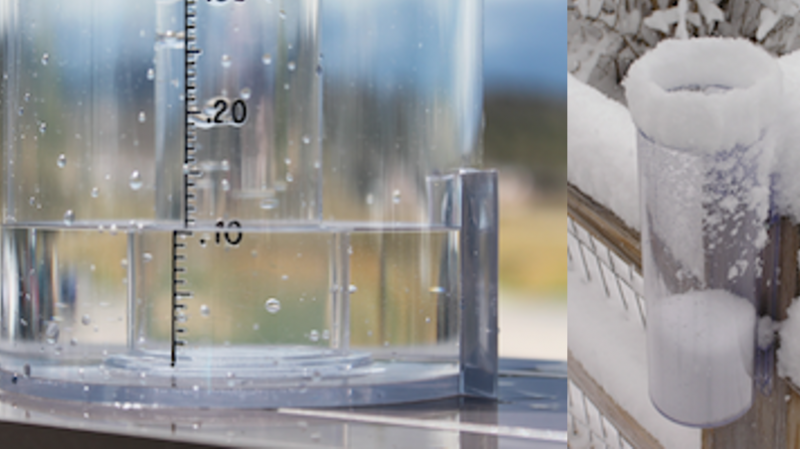
Arguably one of the largest citizen science programs (with over 20,000 current active volunteers!), the Community Collaborative Rain, Hail and Snow network offsite link (CoCoRaHS) originated from the Colorado Climate Center at Colorado State University in 1998. The dedicated CoCoRaHS volunteers have submitted over 50 million daily precipitation observations using standardized manual rain gages mounted in their backyards, workplaces, schools or community centers. In addition to precipitation data, environmental condition offsite link data on soil, plants, water bodies and wildlife are also collected in the CoCoRaHS database. With years of historical data from all 50 states, the observations are important in informing local weather and environmental conditions.
#9 Track historic fish counts with FISHstory
April 12, 2021

FISHstory offsite link is a pilot citizen science project for the South Atlantic Fishery Management Council that gathers catch composition and length data from historic fishing photos from the 1940s-1970s in Daytona Beach, Florida. Volunteers are trained to identify and count fish in the dock photos using an online crowdsourcing platform offsite link. Since launching in May 2020, over 1,930 volunteers have participated in the project making 32,501 fish identifications! Follow along with the South Atlantic Fishery Management Council on social media as they highlight the incredible volunteers that help power their citizen science program.
#10 Record marine mammal sightings with the Channel Islands Naturalist Corps
April 9, 2021

The Channel Islands Naturalist Corps is a group of citizen scientists trained by NOAA Channel Islands National Marine Sanctuary and Channel Islands National Park staff. These volunteers use an app to record near-real time weather conditions and marine mammal sightings while onboard local whale watch vessels in the Santa Barbara Channel. These data serve as important resources to track whales that are entangled or near shipping lanes where they are at risk of ship strikes. You can download the Whale Alert app to report your whale sightings to this project.
#11 Catch and release eels with the Hudson River Eels project
April 8, 2021
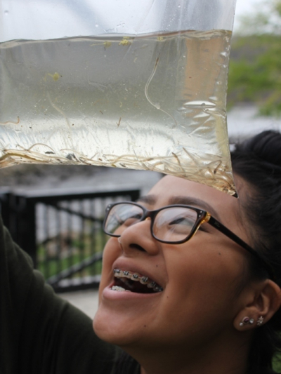
Based in New York, the Hudson River Eels project involves hundreds of volunteers that come together each spring to monitor the annual migration of juvenile American eels as they move from the Atlantic Ocean into the Hudson River. The volunteers catch eels using specialty nets and carefully weigh them before releasing them upstream. Volunteers recently collected the 1 millionth eel since the project began in 2008, a major milestone! Check out the program’s online resources including virtual classroom presentations and new informational videos about the project.
#12 Collect fishery sustainability data with the California Collaborative Fisheries Research Program
April 7, 2021
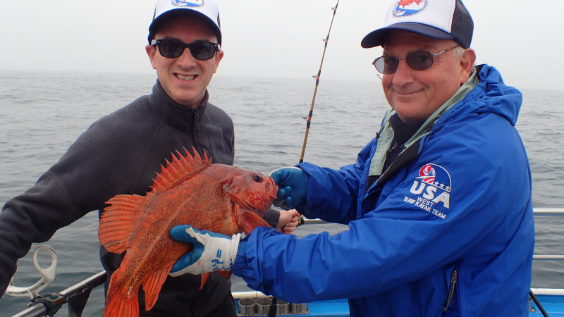
Since 2007, California Collaborative Fisheries Research Program offsite link has worked with local charter boats and numerous volunteer anglers to monitor central California Marine Protected Areas (MPAs). The 1,730 volunteers throughout California are combining their expertise to collect vital fishery data and establish sustainability protocols for MPA management. Volunteer offsite link with the project, watch program highlight videos offsite link, and join their 2021 workshops!
#13 Record historic marine weather observations with the Old Weather WWII project
April 6, 2021

Marine weather observations have been logged on naval ships since the 1850’s. The Old Weather WWII offsite link citizen science project works to recover hidden marine weather data recorded in the U.S. Navy ships' logbooks during World War II. Currently 1,700 volunteers are working virtually to record these entries, which will inform climate science models while also shining a new light on the dedicated work of thousands of service members who collected these observations during this pivotal time in our nation's history.
#14 Monitor horseshoe crabs with the Florida Horseshoe Crab Watch
April 5, 2021
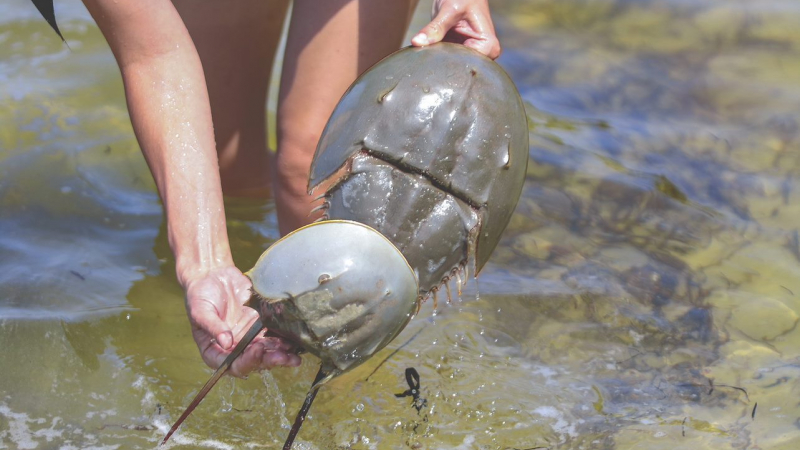
Horseshoe crabs have been around for millions of years and can often be found on our shorelines ranging from Maine to the The Gulf of Mexico. These impressive organisms are the focus of the Florida Horseshoe Crab Watch offsite link. Volunteers are trained to count, measure, weigh, and tag horseshoe crabs, and the data are contributed to a United States Fish and Wildlife Service’s mark-recapture program along the Atlantic Coast. Florida Horseshoe Crab Watch beach surveys are currently underway through May 2021 during the full and new moon when horseshoe crabs come to shore to mate.
#15 Spot severe weather with NOAA NWS SKYWARN®
April 2, 2021
In an average year, the United States can experience thousands of floods and severe storms that impact local communities. SKYWARN is a national citizen science program that trains volunteers to spot severe weather events and report them to the National Weather Service. With over 350,000 trained spotters, the volunteers provide essential information for all types of weather hazards in order to help protect others in their community. Learn how to become a SKYWARN spotter offsite link!
About citizen science at NOAA
NOAA has a rich tradition of engaging citizen science volunteers, and we thank them for helping us solve the challenges we face through the power of the crowd! NOAA has identified citizen science as a Science and Technology Focus Area and has developed a new Citizen Science Strategy to inspire and engage citizen scientists around the world.
“Citizen science allows NOAA to engage the American public, address societal needs and accelerate science, technology, and innovation," says Louisa Koch, Director of Education. “We are grateful to the hundreds of thousands of volunteers who are the heart of these efforts.”


