• Home
  • Weather
  • Climate
  • Ocean & Coasts
  • Fisheries
  • Satellites
  • Research
  • Marine & Aviation
  • Charting
  • Sanctuaries
  • Education
  • News and features
  • Tools & resources
  • About our agency
U.S. flag

An official website of the United States government

Dot gov

Official websites use .gov
A .gov website belongs to an official government organization in the United States.

SSL

Secure .gov websites use HTTPS
A lock ( lock icon ) or https:// means you’ve safely connected to the .gov website. Share sensitive information only on official, secure websites..

Find your local weather
Change location:
  • News
  • Tools
  • About
 
 
NOAA mobile logo
NOAA logo National Oceanic and Atmospheric Administration U.S. Department of Commerce


Topic: Aerial imagery

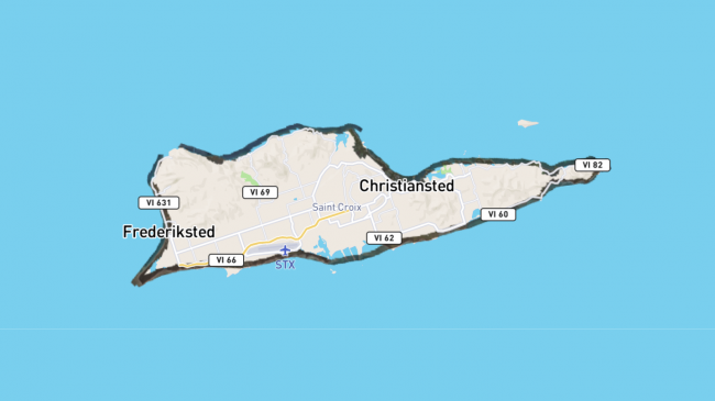
Online images of areas affected by Hurricane Maria will appear as dark ribbons overlaid on the map. To view the photos simply zoom in on the location of interest.
Assessing Maria's destruction from the air: Aerial photos are available
September 23, 2017
Focus areas:
Charting
Marine & Aviation
Ocean & Coasts
Topics:
aerial imagery
hurricanes
Online images of areas affected by Hurricane Maria will appear as dark ribbons overlaid on the map. To view the photos simply zoom in on the location of interest.
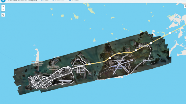
This is what the online images of coastline affected by Hurricane Irma looks like after zooming into a photographed location, as indicated by a dark ribbon overlaid onto the map.
Assessing Irma’s destruction from the air: Aerial images available
September 12, 2017
Focus areas:
Charting
Marine & Aviation
Ocean & Coasts
Topics:
aerial imagery
hurricanes
This is what the online images of coastline affected by Hurricane Irma looks like after zooming into a photographed location, as indicated by a dark ribbon overlaid onto the map.
Overhead views of area near Lynchburg, Texas, before (on left) and after Harvey (on right, taken August 31, 2017).
View NOAA's before-and-after aerial images of Harvey damage
September 5, 2017
Focus areas:
Charting
Ocean & Coasts
Topics:
aerial imagery
flooding
Overhead views of area near Lynchburg, Texas, before (on left) and after Harvey (on right, taken August 31, 2017).
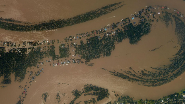
A NOAA aerial image from a NOAA overlight of damage from Harvey in the Rio Villa area of Houston, Texas. August 31, 2017 photo.
NOAA aerial images of Harvey damage now available online
September 1, 2017
Focus areas:
Charting
Marine & Aviation
Ocean & Coasts
Topics:
aerial imagery
hurricanes
A NOAA aerial image from a NOAA overlight of damage from Harvey in the Rio Villa area of Houston, Texas. August 31, 2017 photo.
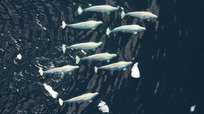
Aerial view of Beluga whales in the Arctic.
Long-term surveys help identify endangered beluga population range
July 15, 2016
Focus areas:
Fisheries
Topics:
fisheries
whales
endangered species
research
surveys
aerial imagery
Aerial view of Beluga whales in the Arctic.

Pagination

  • Previous page ‹
  • Currently on page 2 2
Subscribe to aerial imagery
Back to top
NOAA Home
Science. Service. Stewardship.
  • News
  • Tools
  • About
  • Resources for Tribes
  • Protecting Your Privacy
  • FOIA
  • Information Quality
  • Accessibility
  • Guidance
  • Budget & Performance
  • Disclaimer
  • EEO
  • No-Fear Act
  • USA.gov
  • Ready.gov
  • Employee Check-In
  • Staff Directory
  • Contact Us
  • Need Help?
  • COVID-19 hub for NOAA personnel offsite link
Stay connected to NOAA
NOAA on Twitter NOAA on Facebook NOAA on Instagram NOAA on YouTube
How are we doing?
Feedback opens in new window