Tiny tutorial: Environmental Response Management Application (ERMA®)

The Environmental Response Management Application (ERMA®) is an online mapping tool from the Office of Response and Restoration, which integrates data, like habitats, weather, and currents, into one location for experts responding to environmental disasters like hurricanes or oil spills. Explore more educational resources in our oil spills and hurricanes collections. 

Animated tiny tutorial for accessing information from the Environmental Response Management Application (ERMA) mapping tool.

Below, you can go through each step at your own pace.
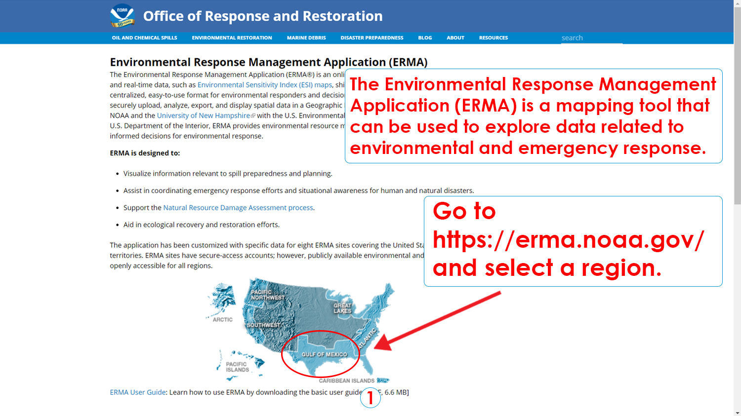
Step 1: Go to https://erma.noaa.gov and select a region. 
The Environmental Response Management Application (ERMA) is a mapping tool that can be used to explore data related to environmental and emergency response.
Step 1: Go to https://erma.noaa.gov and select a region. The Environmental Response Management Application (ERMA) is a mapping tool that can be used to explore data related to environmental and emergency response. (NOAA Education)
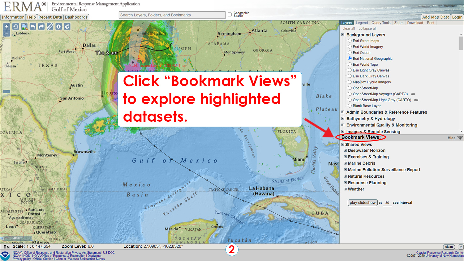
Step 2: Click "Bookmark Views" to explore highlighted datasets.
Step 2: Click "Bookmark Views" to explore highlighted datasets. (NOAA Education)
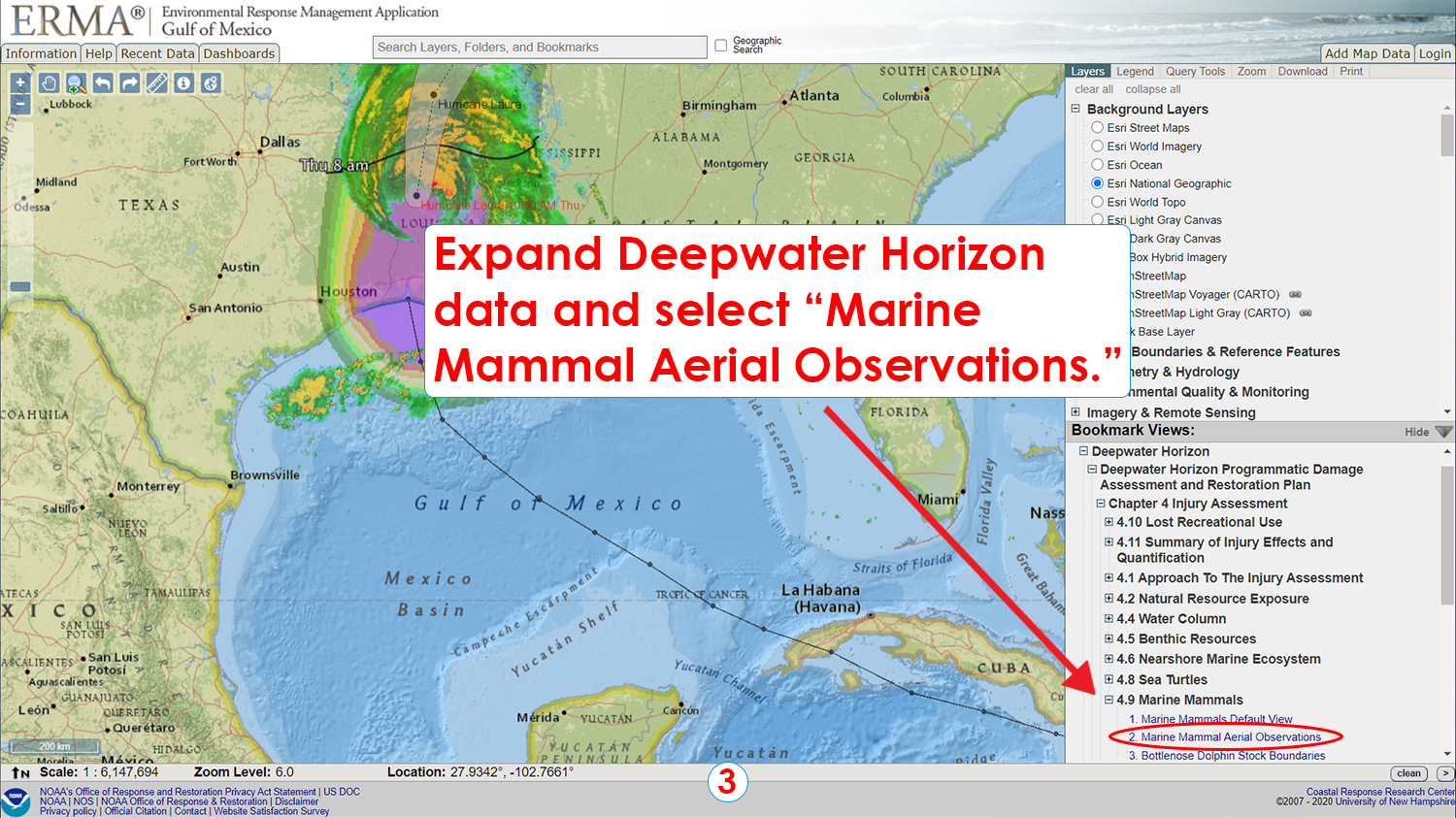
Step 3: Expand Deepwater Horizon data and select "Marine Mammal Aerial Observations."
Step 3: Expand Deepwater Horizon data and select "Marine Mammal Aerial Observations." (NOAA Education)
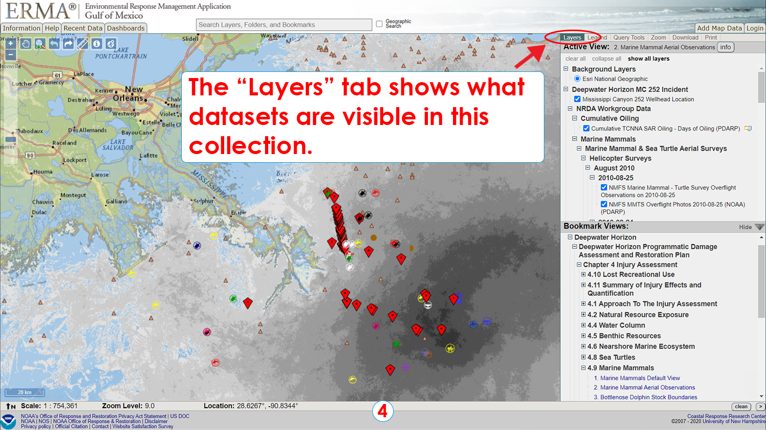
Step 4: The "Layers" tab shows what datasets are visible in this collection.
Step 4: The "Layers" tab shows what datasets are visible in this collection. (NOAA Education)
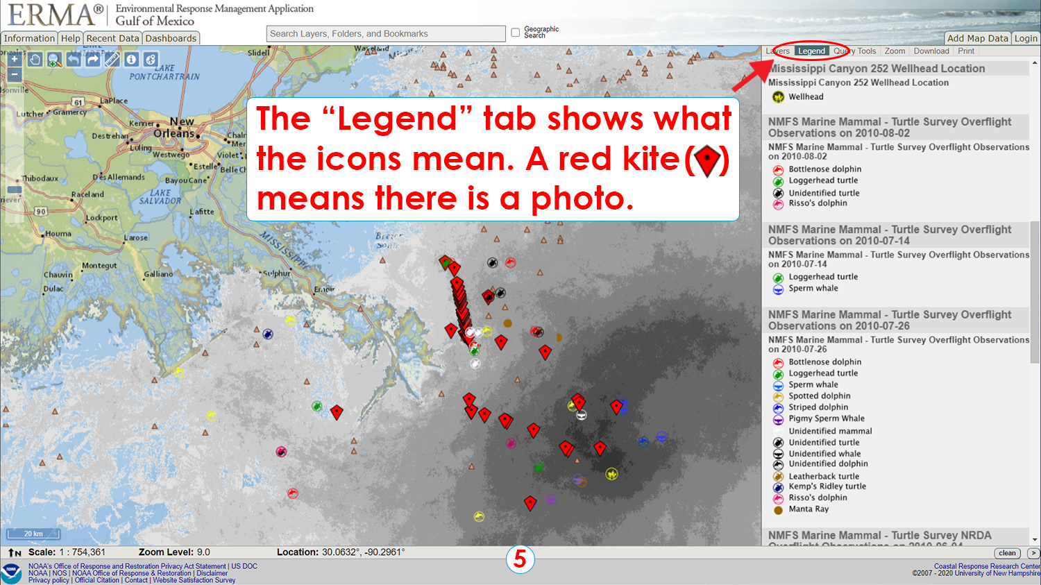
Step 5: The "Legend" tab shows what the icons mean. A red kite (red diamond shape with a black dot in the center) means there is a photo.
Step 5: The "Legend" tab shows what the icons mean. A red kite (red diamond shape with a black dot in the center) means there is a photo. (NOAA Education)
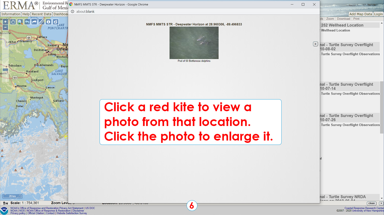
Step 6: Click a red kite to view a photo from that location. Click the photo to enlarge it.
Step 6: Click a red kite to view a photo from that location. Click the photo to enlarge it. (NOAA Education)
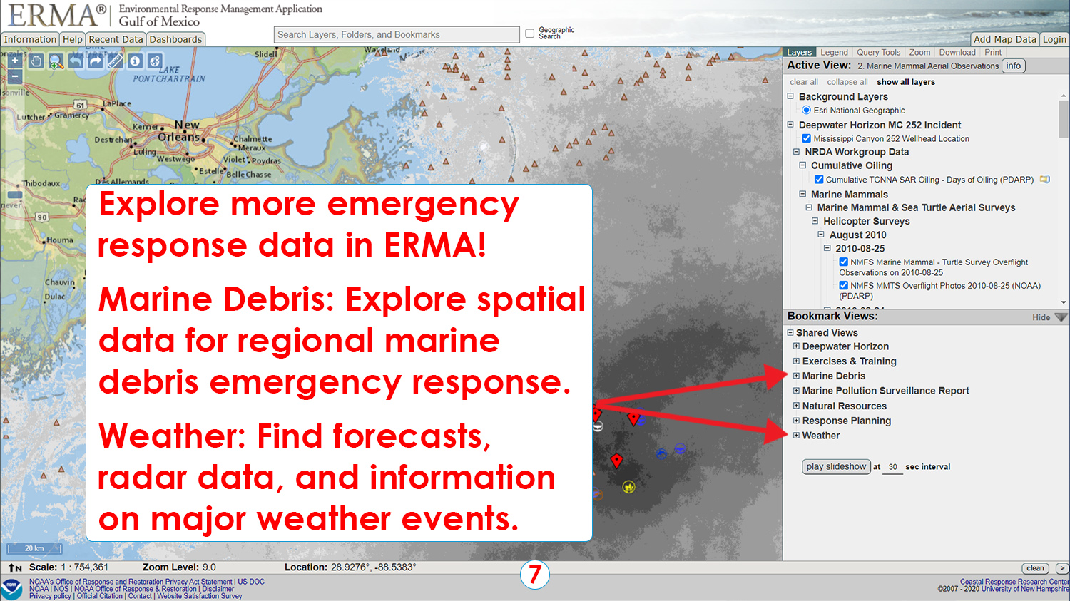
Step 7: Explore more emergency response data in ERMA!
Marine Debris: Explore spatial data for regional marine debris emergency response.
Weather: Find forecasts, radar data, and information on major weather events.
Step 7: Explore more emergency response data in ERMA! Marine Debris: Explore spatial data for regional marine debris emergency response. Weather: Find forecasts, radar data, and information on major weather events. (NOAA Education)