NOAA satellites helped save 250 lives in 2015

Last November in the skies north of Las Cruces, New Mexico, a U.S. Air Force pilot ejected from his F-16 fighter jet. When he safely reached the ground, the signal from his personal locator beacon, or PLB, was promptly picked up by NOAA satellites; the same spacecraft that help predict and track weather in the United States. That distress signal set into motion a coordinated rescue mission that brought him safely back to his family. 
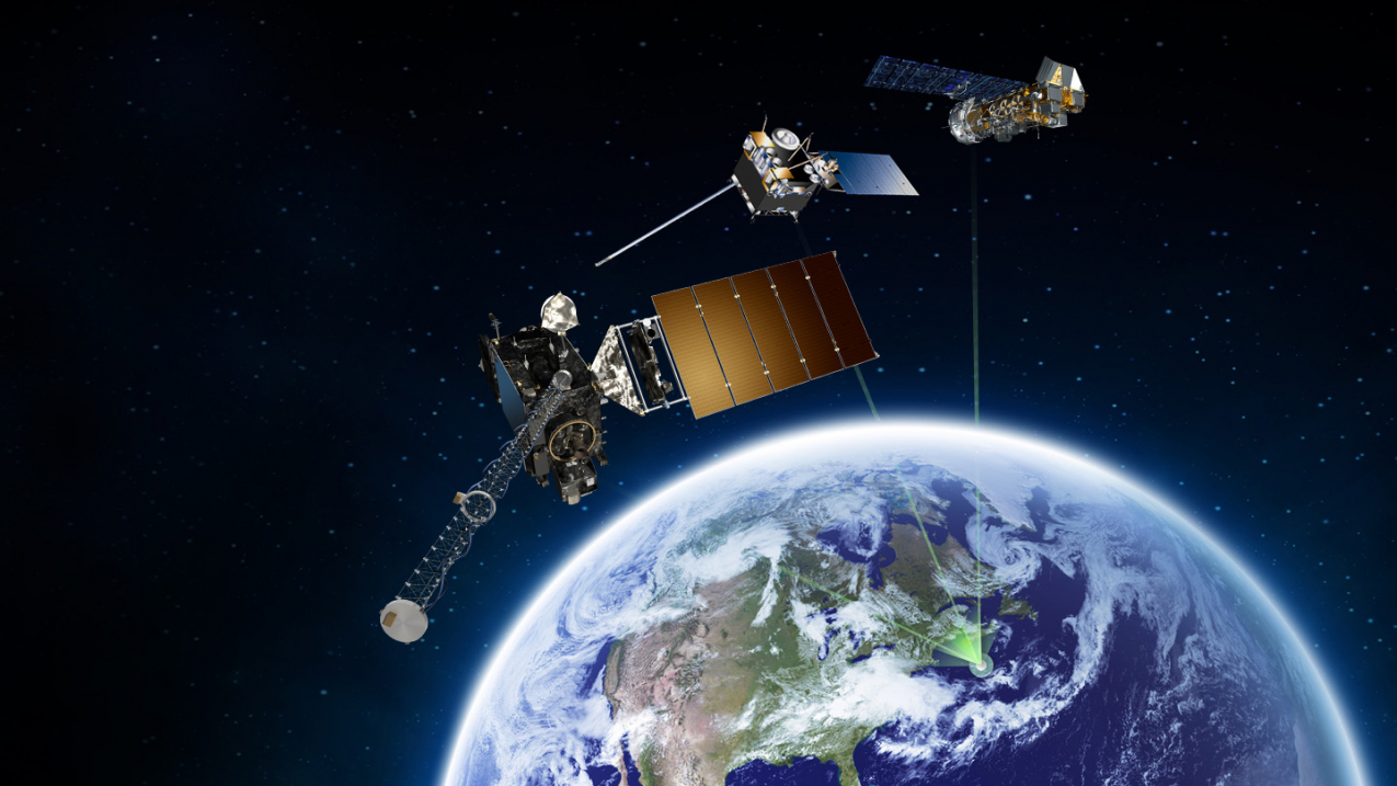
NOAA polar orbiting (right), geostationary (middle), and the new GOES-R series (left) satellites are part of the SARSAT constellation.

NOAA polar orbiting (right), geostationary (middle), and the new GOES-R series (left) satellites are part of the SARSAT constellation. (Image credit: NOAA)

In addition to their well-known role in predicting weather, NOAA satellites played a vital role in the rescue of 250 people last year from potentially life-threatening situations throughout the United States and its surrounding waters.

NOAA satellites are part of the International Search and Rescue Satellite Aided Tracking System, known as COSPAS-SARSAT. This system uses a network of spacecraft to detect and locate distress signals quickly from emergency beacons onboard aircraft and boats, and from hand-held Personal Locator Beacons or PLBs.

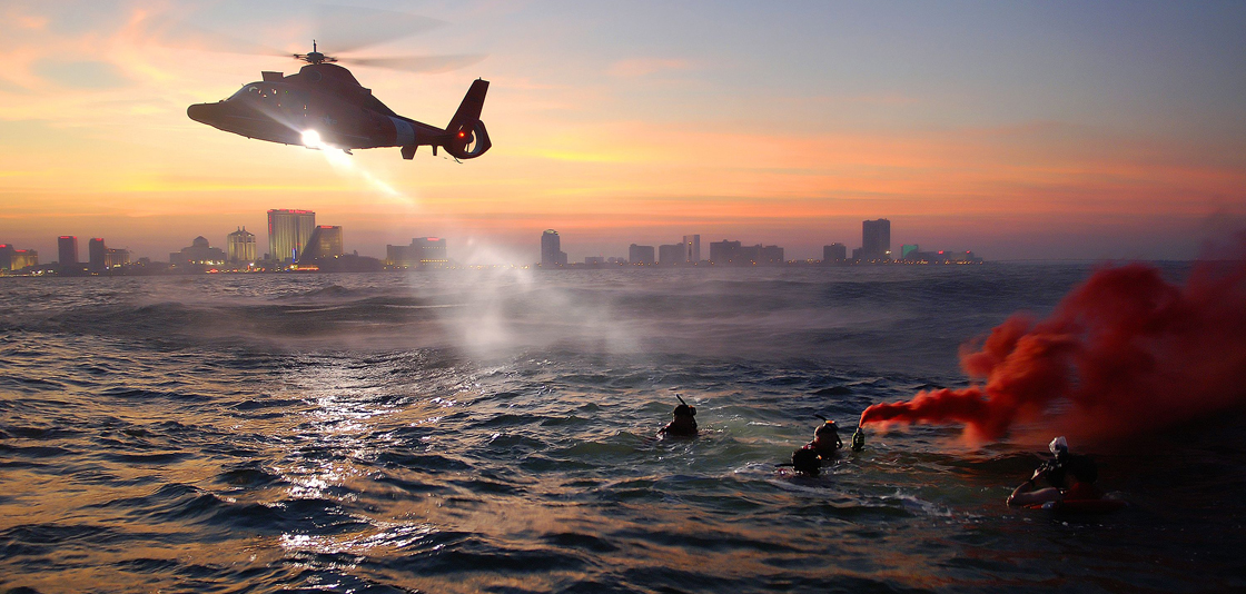
U.S. Coast Guard rescue swimmers from Coast Guard Air Station Atlantic City train off of the coast Atlantic City, New Jersey, during a U.S. Coast Guard Training Exercise.
Coast Guard rescue swimmers train off the coast of Atlantic City, New Jersey. (U.S. Coast Guard photo)

With specialized technology onboard, NOAA’s polar-orbiting and geostationary satellites can detect the location of downed pilots, shipwrecked boaters and stranded hikers.  As the satellites capture the distress signal, it is relayed to the SARSAT Mission Control Center based at NOAA’s Satellite Operations Facility in Suitland, Maryland. From there, the information is quickly sent to a Rescue Coordination Center, operated by either the U.S. Air Force for land rescues, or the U.S. Coast Guard for water rescues.

“While NOAA satellites are important tools for generating your local weather forecast, they can also mean the difference between life and death if you find yourself stranded in the wilderness or at sea,” said Chris O’Connors, NOAA SARSAT program manager.

Of last year’s 250 saves, 138 rescues were on the water, 21 were aviation incidents, and 91 were land-based events, where PLBs were used.


SARSAT STATS (2015)
 
  • Alaska had the most SARSAT rescues with 66, followed by Florida, with 31 and Texas, with 19.
 
  • The largest single rescue occurred when eight people were saved near the Bahamas.  NOAA satellites detected the distress signal from a boat that ran out of fuel and a U.S. Coast Guard helicopter rescued the passengers. 
 
  • Since 1982, COSPAS-SARSAT has been credited with supporting more than 39,000 rescues worldwide, including more than 7,760 in the United States and its surrounding waters.
 

Remember, owners of emergency beacons are required to register them with NOAA at: http://www.beaconregistration.noaa.gov That information helps provide better and faster assistance to people in distress. It may also provide information about the location of the emergency, how many people need assistance, what type of help may be needed and other ways to contact the owner. At the end of 2015, NOAA’s registration database contained 472,313 entries.