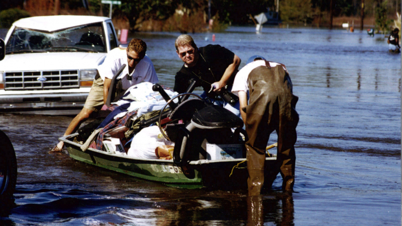
NOAA's National Weather Service monitors potential threats
Coastal residents understand the dangers associated with hurricanes — heavy rainfall, high wind and storm surge can cause a host of problems. But did you know that approximately 25 percent of tropical cyclone-related deaths in the United States do not occur along the coast?
When these powerful storms move over land, they lose wind strength, but continue to dump massive amounts of rain into streams, rivers and lakes — posing a serious threat of inland flooding. These floods account for more than 50 percent of hurricane-related deaths each year.
Before flood water rises, NOAA advises
The NOAA National Weather Service’s robust hydrology program helps protect the nation from the dangers of flooding by monitoring water levels in streams, rivers and lakes, and issuing forecasts and warnings to alert communities when floods threaten.
A major component of the hydrology program is a network of 13 River Forecast Centers spanning the country. These centers provide critical hydrologic information to meteorologists, community decision-makers, and partners in water resource management and flood planning so they can take action in their local communities.
Get the facts from a NOAA hydrologist
The following interview with Jeff Dobur, a senior hydrologist at the National Weather Service’s Southeast River Forecast Center in Peachtree City, Georgia, provides a better understanding of inland flooding, as well as the essential role of the River Forecast Centers (RFC).
Why is inland flooding from hurricanes such a threat?
Approximately 25 percent of U.S. hurricane deaths from 1963-2012 occurred in inland counties, with more than half of tropical hurricane deaths related to freshwater flooding. From what the past has shown, damage from inland flooding caused by these storms can often time run well into the billions of dollars — especially when a major metropolitan area is impacted.
By monitoring potential flooding disasters, the RFCs play a critical role in protecting lives and property during tropical events. Around 70 percent of all hurricanes that impact the U.S. make landfall in the Southeast River Forecast Center’s area of concern and are a major contributor to the total number of significant floods in the Southeast U.S.
What are some of the challenges in predicting inland flooding?
Predicting rainfall is a challenge when forecasting inland flooding. Not only are the total amounts from the storm important, but knowing where the heaviest rain is going to fall is even more critical. A shift of only 30 miles in the expected area of heaviest rainfall can make large differences in the hydrologic response — which rivers are going to flood and which rivers are not.
Inland flooding is a danger that can occur far from where the eye of the hurricane and heavy winds make landfall. For example, during Hurricane Dennis in 2005, the storm track was from far northwest Florida to northern Mississippi. But the heaviest rain and major flooding occurred well north and east in western Georgia and the urban areas of Atlanta.
How do River Forecast Centers communicate the threat of inland flooding?
RFCs provide a variety of hydrologic information to local National Weather Service forecast offices, which then issue critical warning information to the public, emergency management community, and the media through a number of different methods, including NOAA Weather Radio All-Hazards.
During tropical storms or any widespread flood events, the Southeast River Forecast Center conducts daily conference calls highlighting threat areas and potential impacts. Other information is emailed to a number of partners and customers. This information highlights the areas of concern based on the latest storm track and preexisting conditions that may make an area more or less prone to flooding.
Beyond hurricane season, the Southeast River Forecast Center partners with the Federal Emergency Management Agency to provide an inland flooding training session for emergency managers.
What tool is available to give users more insight into the inland flood threat?
The primary tool to get any flood forecast information is through the National Weather Service Advanced Hydrologic Prediction Service (AHPS). AHPS is a web-based suite of products that includes river stage forecasts out through several days.
During an inland flood threat, you can use these forecasts to see the magnitude of flooding that is expected and when it is forecast to occur. This information is essential for emergency managers and other local officials — giving them the lead time needed to make as many preparations as possible.
To learn more about NOAA’s Flood Program and access lifesaving river forecast and flood warning information, visit http://water.weather.gov.