Stay safe with the National Hurricane Center

The Bolivar Peninsula of Texas after Hurricane Ike in September 2008. (Image credit: NOAA)
Thanks to improved computer modeling, several years of experimentation, and even some social science research, NOAA’s National Hurricane Center has new products to help you stay safe should a hurricane or tropical storm come your way. And even though hurricane season starts June 1, these strong storms have been known to hit before – and after – the official season, so the time to prepare is now.
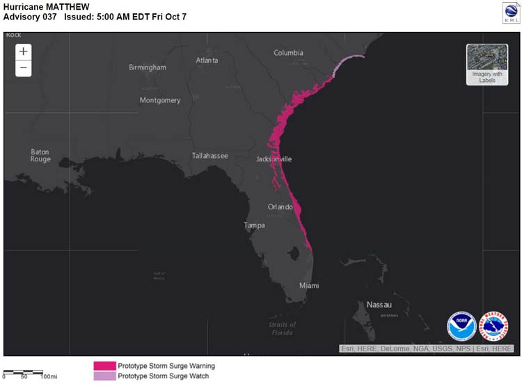
Storm surge
Storm surge is often the greatest threat to life and property from a tropical cyclone. But storm surge doesn’t always occur at the same times or locations as the storm’s dangerous winds. This season, the hurricane center will issue storm surge watches and warnings which will help you understand when evacuations are needed to keep you safe from rising water. A “watch” means a possibility of life-threatening inundation from rising water moving inland from the shoreline, generally within 48 hours. A “warning” means there’s a danger of life-threatening inundation generally within 36 hours.
Potential tropical cyclones
NHC will also issue advisories, watches and warnings for disturbances that aren’t yet a tropical cyclone but still pose a threat of tropical storm or hurricane conditions within 48 hours. With advances in forecasting over the past decade, NHC is confident of forecasting the impacts of these potential storms while they’re still developing, giving people in their path even more time to prepare.
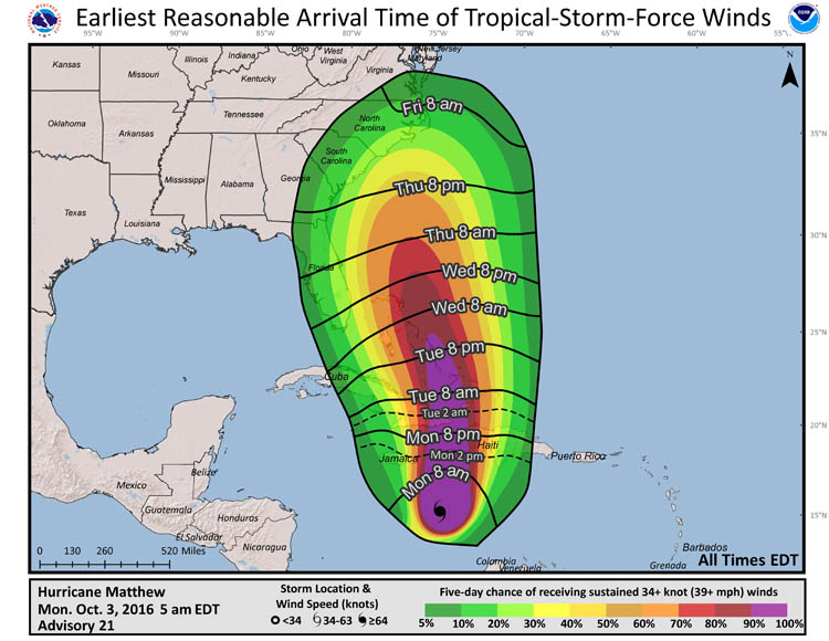
Tropical storm force winds graphics
It’s important to prepare for storms by putting up hurricane shutters, for example, before winds reach tropical-storm-force (39 to 74 mph). To help you plan, the NHC will forecast when those tropical storm force winds will arrive on an experimental basis. Graphics will show the earliest reasonable arrival time, so you know how much time you have to prepare before tropical-storm-force winds may hit - and the most likely arrival time, when tropical-storm-force winds are likely and your preparations should be completed.
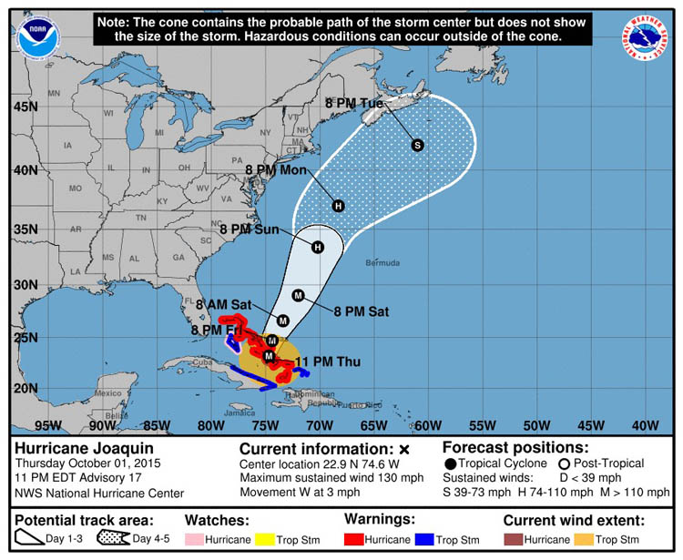
Updated track forecast graphic
There’s also an addition to the familiar track forecast cone graphic. You’ll be able to see the current extent of hurricane and tropical-storm-force winds, with just a click. Remember, hazardous conditions can occur well outside of the cone.
Media contact:
Dennis Feltgen, 305-229-4404


