Rain – and plenty of it – was the big weather story in June, adding to a record-breaking 12 months of precipitation for the contiguous U.S. It's the third consecutive time in 2019 (April, May and June) the past 12-month precipitation record has hit an all-time high.

From NOAA’s National Weather Service: Just 367 days after the last of the Great June Flood of 2018 had left its memorable mark on nearly all of the populated Rio Grande Valley, a confluence of atmospheric events came together during the late afternoon and evening of June 24, 2019. New daily rainfall records were set at most available Rio Grande Valley climate recording locations, including Harlingen, Texas, (shown) with 6.29 inches of rain -- about 3 times the monthly average. (Image credit: NOAA NWS)
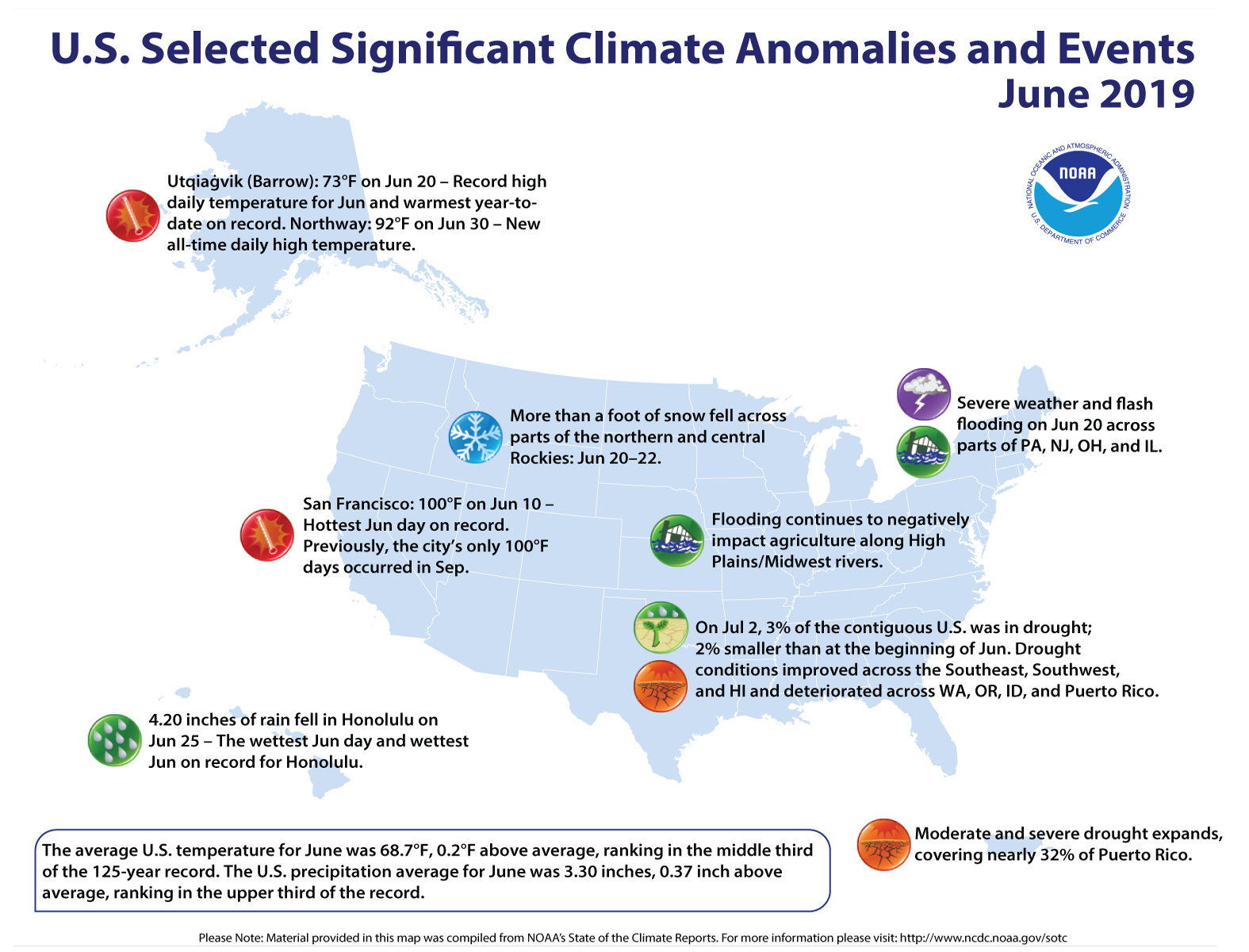
Here’s a snapshot of NOAA’s U.S. climate report for June and the year to date:
Climate by the numbers
June 2019
Wet conditions from July 2018 through June 2019 resulted in a new 12-month precipitation record in the U.S., with an average of 37.86 inches (7.90 inches above average), according to scientists at NOAA’s National Centers for Environmental Information.
The average precipitation for June was 3.30 inches (0.37of an inch above average), placing it in the upper third in the record books. Flooding conditions persisted along the central and Lower Mississippi, Missouri and Illinois rivers.
The average June temperature across the contiguous U.S. was 68.7 degrees F (0.2 degrees above average), which ranked in the middle third of the 125-year record. Eleven states along the Pacific, Gulf, New England and the Mid-Atlantic coasts had much-above-average temperatures.
Year to date | January through June
The average U.S. temperature for the year to date (January through June) was 47.6 degrees F (0.1 of a degree above average), which ranked in the middle third for the six-month period. Through June, the average total precipitation for the year – 19.05 inches – was 3.74 inches above average.

More highlights from the report
-
Drought was a mixed bag: About 3.2 percent of the contiguous U.S. was in drought, down from 5.3 percent at the start of June. However, drought conditions worsened across parts of the Pacific Northwest and Puerto Rico.
-
Alaska baked: The northernmost state had its second hottest June on record, with an average temperature of 54.0 degrees F (4.8 degrees above average.)
-
Billion-dollar disasters count holds steady: By the year's halfway mark, the U.S. has six such disasters on the books, including four destructive severe storms and two flooding events.
View NOAA’s latest report and download the images from the NCEI website.
Media contact
John Leslie, (301)-713-0214


