An official website of the United States government
Official websites use .gov
A .gov
website belongs to an official government organization in the United States.
Secure .gov websites use HTTPS
A lock (
) or https:// means you’ve safely connected to the .gov website. Share sensitive information only on official, secure websites..
This spring NOAA meteorologists hopped into trucks to drive thousands of miles across the Great Plains in search of storms. With an unimpeded view of the sky and storms that can grow miles high, the plains are the perfect laboratory to examine swirls inside a thunderstorm that can lead to tornadoes.
Once they spotted a storm, they drove their two trucks with roof-mounted instruments right up to it and back and forth underneath it. For the first time researchers targeted a relatively unexplored part of the storm in the expected path of the tornado, and where large hail often occurs. Understanding winds and temperatures here is key to predicting how strong, long-lived and dangerous a tornado may be.
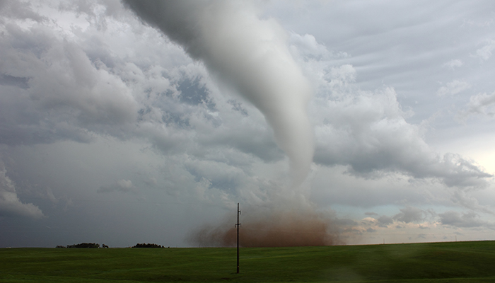
A tornado crossing the road
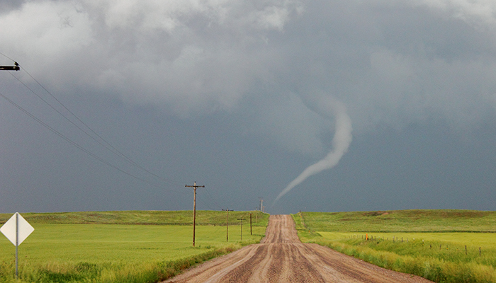
Looking north, researchers watch this tornado near Bushnell, Nebraska, on June 12 move from the east side of the road to the west. This is unusual because most tornadoes track west to east. It was the last day - and the best day - of the research team’s three-week long, 10,000 mile road trip through eight states. Instruments on their trucks measured wind speed and direction, temperature, pressure and dew point every second, adding up to about 35,000 points of data each day. (Sean Waugh, NOAA NSSL)
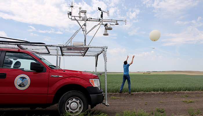
Erik Rasmussen, coordinator of the NOAA National Severe Storms Laboratory-funded project and University of Oklahoma Cooperative Institute for Mesoscale Meteorological Studies researcher, sends a weather balloon aloft on May 31 near Salina, Kansas. The balloons travel about 80,000 feet, measuring basic atmospheric conditions. The radio-transmitted data provide researchers with guidance for when and where storms will form. (Matthew Flournoy, OU CIMMS and NOAA NSSL)
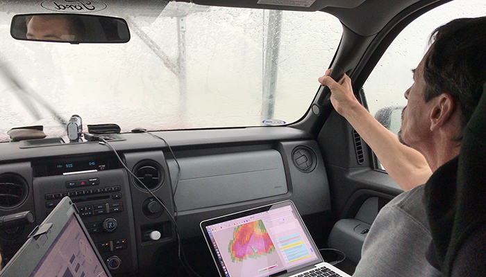
Erik Rasmussen holds on tight as the research truck heads into white-out conditions from heavy rain, strong winds and large hail near Lubbock, Texas, to get measurements in an area of a storm researchers previously avoided. As project coordinator, he monitors radar and other sensors while organizing project participants. Project partners include Penn State University, Texas Tech University, University of Colorado, and University of Nebraska-Lincoln. (Brandon Smith, OU CIMMS/NSSL)
Touching down just next to the researchers, this June 12 tornado near Cheyenne, Wyoming, was the first of several tornadoes sampled during one dramatic, busy day. Soon after, a second tornado from the same storm formed nearby. About an hour later, another storm produced at least two more tornadoes. Hail as large as baseballs pounded the research vehicles during these storms. A metal wire cage custom-built by an NSSL scientist shielded the roof and hood of the truck, protecting the front windshield and the researchers. (Sean Waugh, NOAA NSSL)
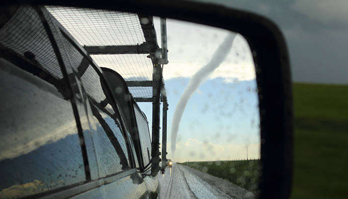
With a tornado from a dying Wyoming storm in their rear view mirror, researchers are headed to another storm nearby to continue collecting data. It will take researchers months to analyze all of it. Knowledge gained from analysis of the data will help forecasters better understand and predict tornadoes. (Sean Waugh, NOAA NSSL)