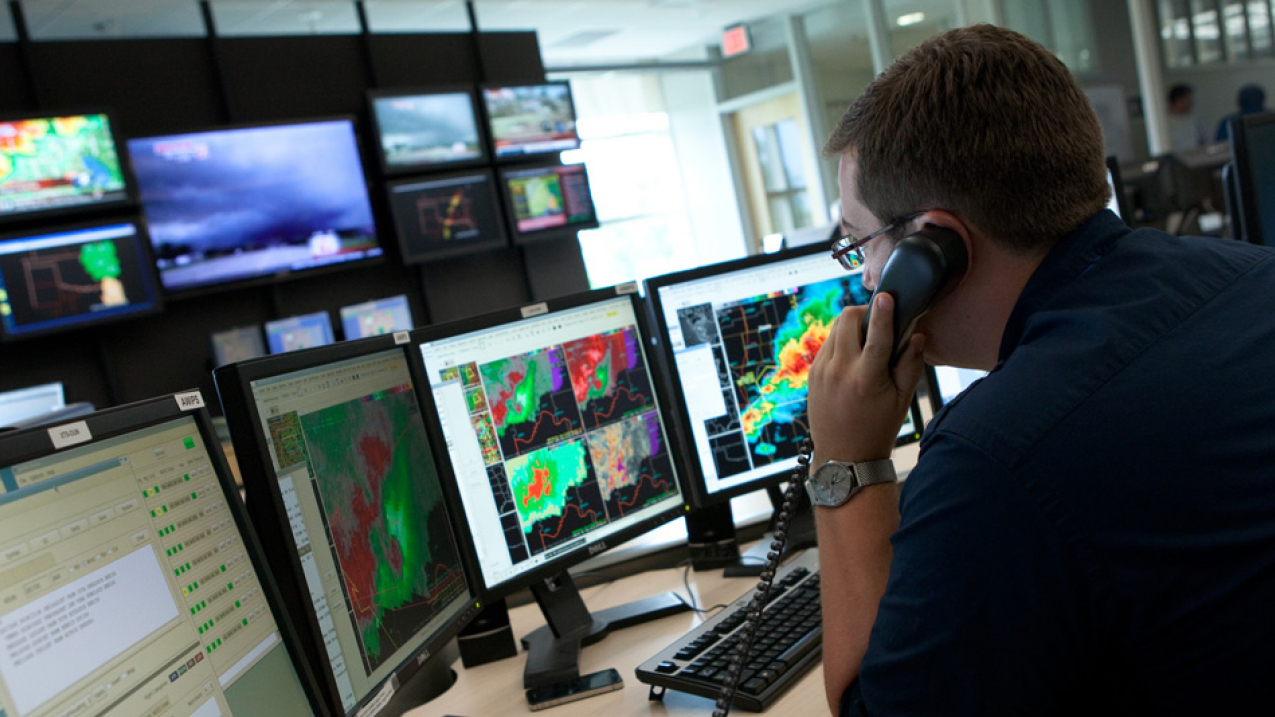
A National Weather Service meteorologist in Norman, Oklahoma, tracks a super cell tornado outbreak. (Image credit: NOAA)
Improving weather forecasts
Building a Weather-Ready Nation
Taking the pulse of the planet
Processing enormous amounts of data
Evolving forecast services
Weather forecasts are becoming more detailed, more accurate and are extending further out in time — providing the information needed to make sound decisions to protect life and property. Technological advances, such as apps, are making weather information more accessible and immediately alerting those in harm’s way.
Before a sun, cloud or rain icon is posted on a website or a text is sent to a mobile phone ahead of dangerous weather, a complex process takes place. It involves the collection and processing of data that yields an understandable and actionable forecast.

As the quantity and quality of observations have improved, as computer modeling has become more detailed, as supercomputing has become more powerful, and as researchers study the mysteries of our weather and climate — so, too, have forecasts improved and will continue to improve.
Hurricanes once surprised people, such as the Hurricane of 1938 that hit Long Island, New York, with no warning. Today, NOAA’s National Hurricane Center is able to issue five-day forecasts for hurricanes such as Katrina and Sandy thanks to better observations, atmospheric computer modeling and the use of satellites that are a forecaster’s “eye in the sky.”
Tornadoes cloaked by the darkness of night or embedded within heavy rain are now revealed by National Weather Service Doppler radar and by its ability to tell the difference between precipitation and debris that’s lofted in the air by a funnel that has reached the ground.
Every advancement in weather forecasting has led to safer travel on roads, in the air, at sea; businesses that can improve safety, productivity, profit; emergency managers that direct residents away from harm; a nation that is more ready, responsive and resilient to natural disasters.
Still, scientists are diligently working to address remaining forecast challenges, such as improving forecasts of rapidly strengthening or weakening hurricanes and extending the lead time for tornado and flood warnings.
Weather forecasting begins with observing the current state of the atmosphere. From that starting point, forecasters can then predict upcoming changes to the weather in the minutes, hours, days and weeks to come. Sensors on land, sea, in the air and orbiting in space measure a range of weather conditions and provide billions of observations from around the globe that help paint the most complete picture of our planet as possible.
Within the U.S., NOAA’s National Weather Service operates a range of tools to measure the ocean and atmosphere, some examples:
90%
—Portion of the weather data provided by satellites, which feed computer models
- On land, there is the network of Automated Surface Observing Systems that measures current weather, visibility, precipitation and other conditions at airports. There is also the network of more than 120 Doppler radars — now enhanced with Dual Polarization Technology — that scan the skies for precipitation type and intensity which aids the forecasts of floods and the transition of precipitation (e.g., rain changing to heavy snow).
- On the water, buoys measure a range of conditions such as sea surface temperatures and wave heights — crucial data for routine marine forecasts and for measuring powerful nor’easters and hurricanes. And, bobbing in strategic locations in the Pacific Ocean, Atlantic Ocean, Gulf of Mexico and Caribbean are DART (Deep-ocean Assessment and Reporting of Tsunamis) buoys — with a sensor extending to the ocean floor that alerts forecasters to an undersea earthquake and the threat of a tsunami.
- In the air, weather balloons are launched daily across the country to measure conditions upwards of 115,000 feet. And, the NWS has partnered with some commercial airlines to equip aircraft with sensors to take observations during takeoff, in flight and through landing. To best study tropical storms and hurricanes, crews from NOAA and the U.S. Air Force fly special hurricane hunter planes into and around storms to measure intensity and the surrounding wind patterns that steer them. NOAA’s aircraft also now carry tail Doppler radar that gives an even more detailed look inside the complex structure of these dangerous storms.
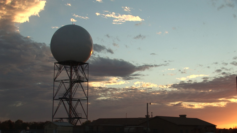
Each of the data points are essential for painting the picture forecasters need. But there are gaps between these specific points — gaps that are filled by satellites. Orbiting Earth is a constellation of satellites that track storms and can measure conditions such as temperature, moisture and wind.
NOAA operates two types of satellites — geostationary and polar-orbiting — that continuously provide real-time data and imagery, which are fed into NOAA's weather prediction models. NOAA is working to launch advanced geostationary and polar-orbiting satellites, called GOES-R and the Joint Polar Satellite System (JPSS), respectively. When launched, beginning in 2016, GOES-R will provide satellite images every 30 seconds of major storms and offer significantly improved data collection capabilities. JPSS, set to launch in 2017, will be critical for weather prediction beyond 48 hours and increase the consistency and accuracy of forecasts three to seven days in advance of a severe weather event.
Weather prediction is truly a community effort. The National Weather Service is able to measure and predict the oceans and atmosphere by also leveraging strong relationships with other domestic agencies and the international community.
Converting the billions of data points collected every day around the globe into reliable forecasts requires an incredible supercomputing capacity able to process highly-detailed computer models.
2.8 quadrillion
The number of mathematical calculations in 1 second that NOAA computers complete
NOAA uses supercomputers to process observation data and to run complex weather and climate models based on complex calculations. The results provide meteorologists with a roadmap for producing forecasts.
Steady increases in NOAA’s supercomputing capacity have allowed improvements in computer forecast modeling, driven by researchers with NOAA’s Office of Oceanic and Atmospheric Research and put into operation for NOAA’s National Weather Service. These models are providing forecasters at the National Weather Service and throughout the weather enterprise, including private sector companies and broadcast meteorologists, a more long-range and detailed look into the future state of our atmosphere.
Among the models operated by the National Weather Service that have undergone significant improvements:
- Global Forecast System model: The primary model for U.S. weather has been upgraded with greater resolution that extends further out in time. By shrinking the model’s grids, forecasters now have more detailed information about weather occurring at a neighborhood level instead of a city level.
- High-Resolution Rapid Refresh model: Provides forecasters more detailed, short-term information about small-scale storms by combining higher detail, more frequent radar input and an advanced representation of clouds and winds. This model forecasts are run in high resolution every hour using the most recent observations with forecasts extending out 15 hours, allowing forecasters to better monitor rapidly developing and evolving localized storms. With this information forecasters can better anticipate and predict the onset of a storm and critical details of its evolution, allowing for earlier watches and warnings.
- Hurricane Weather Research and Forecasting model: Upgrades to this model marks the first time NOAA models have had direct connections between the air, ocean and waves to improve forecasts of hurricane tracks and intensity. This upgrade allows NOAA to forecast for up to 8 storms at any given time.
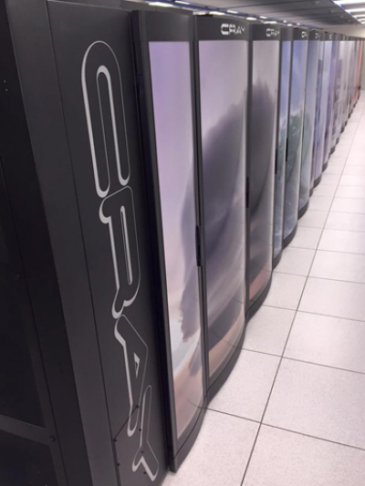
In January 2016, NOAA announced a four-fold increase in supercomputing capacity with the addition of two Cray supercomputers to the existing two IBMs to comprise America’s Weather and Climate Operational Supercomputing System.
Powerful supercomputers and high-resolution models serve to help the ultimate forecasting tool: humans. No one model is right 100 percent of the time. That’s why forecasters view a collection of models, known as an ensemble, to account for weakness and biases in the models and also weigh their strengths as forecasters issue timely and accurate predictions and provide an array of decision support services.
The impacts of extreme weather, water, and climate events are growing. Destructive and deadly hurricanes and tornadoes, devastating floods, droughts and wildfires, and powerful winter storms are costing the nation’s economy more than ever before.
Munich Re, a leader in global re-insurance, estimates that an annual average of $29.4 billion in insured losses resulted from natural catastrophes in the U.S. between 2000 and 2012. Insured damage due to severe weather in the U.S. in 2013 exceeded $10 billion, despite the lowest tornado count in a decade — the sixth year in a row that losses due to severe weather topped $10 billion.
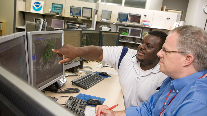
The dedicated and skilled NWS workforce uses advanced technology to understand and predict the weather and produce timely and accurate life-saving forecasts and warnings. More than 4,600 employees in 122 Weather Forecast Offices, 13 River Forecast Centers, 10 National Centers, 21 aviation Center Weather Service Units, and support offices around the country constitute a local, regional, and national weather prediction and service delivery capability unmatched anywhere in the world.
Nevertheless, faced with a growing population at risk, an economy that is increasingly vulnerable to weather and water extremes, an aging infrastructure, and a changing climate, the NWS must also evolve. The demand for environmental data and analysis that informs decisions — whether to protect lives and livelihoods from extreme weather events, or to enhance commerce during routine fair weather — has never been greater. More reliable, timely, accurate, and consistent forecasts, which communicate expected impacts and risks, will provide a basis for critical decisions made by emergency managers and other partners to save lives and property and enhance the national economy.
To ensure that America has a Weather Service that is second-to-none, we need:
- Faster advancement in our computer models to provide more accurate and reliable forecasts and warnings.
- A workforce trained and organized to meet growing needs for decision support services and effective risk communication.
- An active and engaged partnership with our stakeholders and the general public that depends on good weather information to improve our nation’s capacity to build ready, responsive, resilient communities.
The National Weather Service is taking the steps required to evolve into a more effective agency capable of meeting the nation’s growing needs for weather, water, and climate information. With the public’s support, the National Weather Service will evolve to build a Weather-Ready Nation, saving more lives and livelihoods, mitigating impacts from extreme weather, water, and climate events, and strengthening the nation’s economy.
Weather forecasts are becoming more detailed, more accurate and are extending further out in time — providing the information needed to make sound decisions to protect life and property. Technological advances, such as apps, are making weather information more accessible and immediately alerting those in harm’s way.
Before a sun, cloud or rain icon is posted on a website or a text is sent to a mobile phone ahead of dangerous weather, a complex process takes place. It involves the collection and processing of data that yields an understandable and actionable forecast.

As the quantity and quality of observations have improved, as computer modeling has become more detailed, as supercomputing has become more powerful, and as researchers study the mysteries of our weather and climate — so, too, have forecasts improved and will continue to improve.
Hurricanes once surprised people, such as the Hurricane of 1938 that hit Long Island, New York, with no warning. Today, NOAA’s National Hurricane Center is able to issue five-day forecasts for hurricanes such as Katrina and Sandy thanks to better observations, atmospheric computer modeling and the use of satellites that are a forecaster’s “eye in the sky.”
Tornadoes cloaked by the darkness of night or embedded within heavy rain are now revealed by National Weather Service Doppler radar and by its ability to tell the difference between precipitation and debris that’s lofted in the air by a funnel that has reached the ground.
Every advancement in weather forecasting has led to safer travel on roads, in the air, at sea; businesses that can improve safety, productivity, profit; emergency managers that direct residents away from harm; a nation that is more ready, responsive and resilient to natural disasters.
Still, scientists are diligently working to address remaining forecast challenges, such as improving forecasts of rapidly strengthening or weakening hurricanes and extending the lead time for tornado and flood warnings.
Weather forecasting begins with observing the current state of the atmosphere. From that starting point, forecasters can then predict upcoming changes to the weather in the minutes, hours, days and weeks to come. Sensors on land, sea, in the air and orbiting in space measure a range of weather conditions and provide billions of observations from around the globe that help paint the most complete picture of our planet as possible.
Within the U.S., NOAA’s National Weather Service operates a range of tools to measure the ocean and atmosphere, some examples:
90%
—Portion of the weather data provided by satellites, which feed computer models
- On land, there is the network of Automated Surface Observing Systems that measures current weather, visibility, precipitation and other conditions at airports. There is also the network of more than 120 Doppler radars — now enhanced with Dual Polarization Technology — that scan the skies for precipitation type and intensity which aids the forecasts of floods and the transition of precipitation (e.g., rain changing to heavy snow).
- On the water, buoys measure a range of conditions such as sea surface temperatures and wave heights — crucial data for routine marine forecasts and for measuring powerful nor’easters and hurricanes. And, bobbing in strategic locations in the Pacific Ocean, Atlantic Ocean, Gulf of Mexico and Caribbean are DART (Deep-ocean Assessment and Reporting of Tsunamis) buoys — with a sensor extending to the ocean floor that alerts forecasters to an undersea earthquake and the threat of a tsunami.
- In the air, weather balloons are launched daily across the country to measure conditions upwards of 115,000 feet. And, the NWS has partnered with some commercial airlines to equip aircraft with sensors to take observations during takeoff, in flight and through landing. To best study tropical storms and hurricanes, crews from NOAA and the U.S. Air Force fly special hurricane hunter planes into and around storms to measure intensity and the surrounding wind patterns that steer them. NOAA’s aircraft also now carry tail Doppler radar that gives an even more detailed look inside the complex structure of these dangerous storms.

Each of the data points are essential for painting the picture forecasters need. But there are gaps between these specific points — gaps that are filled by satellites. Orbiting Earth is a constellation of satellites that track storms and can measure conditions such as temperature, moisture and wind.
NOAA operates two types of satellites — geostationary and polar-orbiting — that continuously provide real-time data and imagery, which are fed into NOAA's weather prediction models. NOAA is working to launch advanced geostationary and polar-orbiting satellites, called GOES-R and the Joint Polar Satellite System (JPSS), respectively. When launched, beginning in 2016, GOES-R will provide satellite images every 30 seconds of major storms and offer significantly improved data collection capabilities. JPSS, set to launch in 2017, will be critical for weather prediction beyond 48 hours and increase the consistency and accuracy of forecasts three to seven days in advance of a severe weather event.
Weather prediction is truly a community effort. The National Weather Service is able to measure and predict the oceans and atmosphere by also leveraging strong relationships with other domestic agencies and the international community.
Converting the billions of data points collected every day around the globe into reliable forecasts requires an incredible supercomputing capacity able to process highly-detailed computer models.
2.8 quadrillion
The number of mathematical calculations in 1 second that NOAA computers complete
NOAA uses supercomputers to process observation data and to run complex weather and climate models based on complex calculations. The results provide meteorologists with a roadmap for producing forecasts.
Steady increases in NOAA’s supercomputing capacity have allowed improvements in computer forecast modeling, driven by researchers with NOAA’s Office of Oceanic and Atmospheric Research and put into operation for NOAA’s National Weather Service. These models are providing forecasters at the National Weather Service and throughout the weather enterprise, including private sector companies and broadcast meteorologists, a more long-range and detailed look into the future state of our atmosphere.

Among the models operated by the National Weather Service that have undergone significant improvements:
- Global Forecast System model: The primary model for U.S. weather has been upgraded with greater resolution that extends further out in time. By shrinking the model’s grids, forecasters now have more detailed information about weather occurring at a neighborhood level instead of a city level.
- High-Resolution Rapid Refresh model: Provides forecasters more detailed, short-term information about small-scale storms by combining higher detail, more frequent radar input and an advanced representation of clouds and winds. This model forecasts are run in high resolution every hour using the most recent observations with forecasts extending out 15 hours, allowing forecasters to better monitor rapidly developing and evolving localized storms. With this information forecasters can better anticipate and predict the onset of a storm and critical details of its evolution, allowing for earlier watches and warnings.
- Hurricane Weather Research and Forecasting model: Upgrades to this model marks the first time NOAA models have had direct connections between the air, ocean and waves to improve forecasts of hurricane tracks and intensity. This upgrade allows NOAA to forecast for up to 8 storms at any given time.
In January 2016, NOAA announced a four-fold increase in supercomputing capacity with the addition of two Cray supercomputers to the existing two IBMs to comprise America’s Weather and Climate Operational Supercomputing System.
Powerful supercomputers and high-resolution models serve to help the ultimate forecasting tool: humans. No one model is right 100 percent of the time. That’s why forecasters view a collection of models, known as an ensemble, to account for weakness and biases in the models and also weigh their strengths as forecasters issue timely and accurate predictions and provide an array of decision support services.
The impacts of extreme weather, water, and climate events are growing. Destructive and deadly hurricanes and tornadoes, devastating floods, droughts and wildfires, and powerful winter storms are costing the nation’s economy more than ever before.
Munich Re, a leader in global re-insurance, estimates that an annual average of $29.4 billion in insured losses resulted from natural catastrophes in the U.S. between 2000 and 2012. Insured damage due to severe weather in the U.S. in 2013 exceeded $10 billion, despite the lowest tornado count in a decade — the sixth year in a row that losses due to severe weather topped $10 billion.
The dedicated and skilled NWS workforce uses advanced technology to understand and predict the weather and produce timely and accurate life-saving forecasts and warnings. More than 4,600 employees in 122 Weather Forecast Offices, 13 River Forecast Centers, 10 National Centers, 21 aviation Center Weather Service Units, and support offices around the country constitute a local, regional, and national weather prediction and service delivery capability unmatched anywhere in the world.

Nevertheless, faced with a growing population at risk, an economy that is increasingly vulnerable to weather and water extremes, an aging infrastructure, and a changing climate, the NWS must also evolve. The demand for environmental data and analysis that informs decisions — whether to protect lives and livelihoods from extreme weather events, or to enhance commerce during routine fair weather — has never been greater. More reliable, timely, accurate, and consistent forecasts, which communicate expected impacts and risks, will provide a basis for critical decisions made by emergency managers and other partners to save lives and property and enhance the national economy.
To ensure that America has a Weather Service that is second-to-none, we need:
- Faster advancement in our computer models to provide more accurate and reliable forecasts and warnings.
- A workforce trained and organized to meet growing needs for decision support services and effective risk communication.
- An active and engaged partnership with our stakeholders and the general public that depends on good weather information to improve our nation’s capacity to build ready, responsive, resilient communities.
The National Weather Service is taking the steps required to evolve into a more effective agency capable of meeting the nation’s growing needs for weather, water, and climate information. With the public’s support, the National Weather Service will evolve to build a Weather-Ready Nation, saving more lives and livelihoods, mitigating impacts from extreme weather, water, and climate events, and strengthening the nation’s economy.


