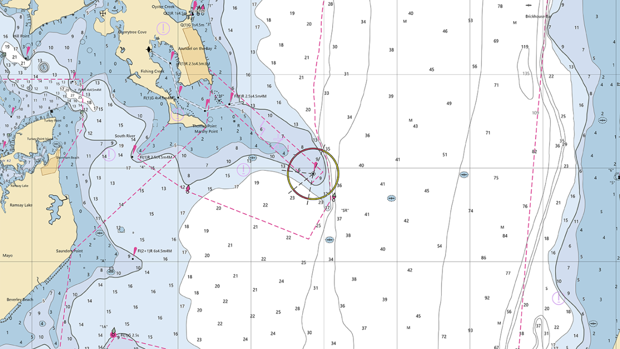
An image of a nautical chart showing a portion of the western Chesapeake Bay shore near Thomas Point and Annapolis, Maryland. The nautical chart uses electronic navigational chart data and was generated using NOAA's Custom Chart application. (Image credit: NOAA)
This fall, a massive new dataset release will help maritime navigation become safer, easier and more efficient.
The data, made possible through the Harmonized Waterway project, is part of an effort to synchronize identifiers (such as names and abbreviations) for rivers, bays and maritime landmarks across all government agencies. NOAA, the U.S. Coast Guard (USGC) and the Department of Homeland Security are contributors to the project.
The seafloor and coastline are dynamic environments — that’s why all of the government’s mapping products are constantly scrutinized for possible changes. In any given year there can be thousands of updates to these products.
“The Harmonized Waterway project will help immensely as we transition away from traditional paper charts and focus on electronic charts as the primary product for navigation,” said Admiral Benjamin Evans, director of NOAA’s Office of Coast Survey. “Working in concert with other agencies helps us do this in an efficient, unified manner.”
In the past, if an emergency occurred on the water or a shipping channel was altered, NOAA’s navigational charts were amended to reflect the change. The USGC would then reference the changes using chart numbers in each of its weekly Local Notice to Mariner reports. Federal and state entities occasionally gave distinct names and identifiers to the same features and landmarks, leading to potential confusion for recreational boaters, commercial fisherman and companies involved in international shipping.
In 2019, NOAA began to shift from paper charts to electronic navigational charts and online mapping tools. NOAA also began to uniquely identify waterways as a part of the Waterway Harmonization project. Doing so ensured that all involved agencies were in agreement about what to call each feature.
As a part of the move to phase out the old paper charting system, NOAA is also running a pilot program that allows citizens to submit their own data about waterways and landmarks for expert verification, further highlighting the need to standardize naming conventions. Previously the source data for most of the updates made to nautical charts came from NOAA research teams or contractor surveys, or from federal partners.
Once completed the new charting system and all of the new naming conventions will be fully accessible to the public.
For more information, see the Department of Homeland Security’s Harmonized Waterway project press release.


