
NOAA offers expertise on forecasting and monitoring drought conditions
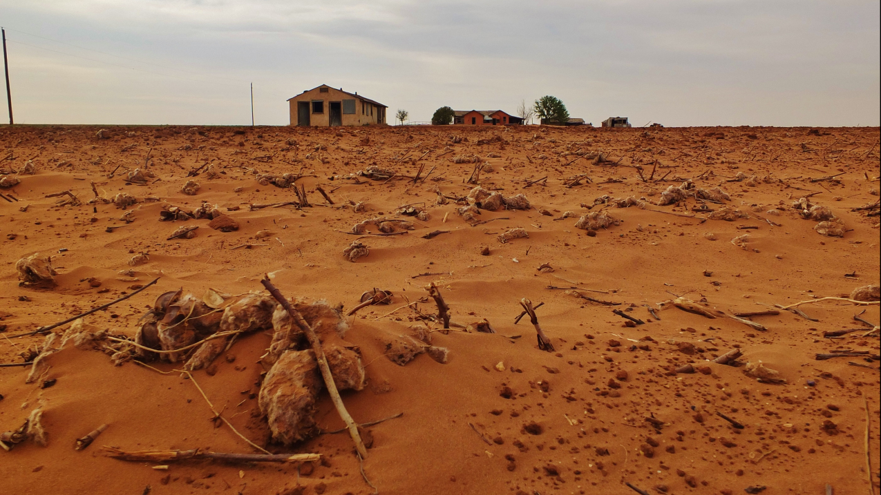
EDDI, a tool developed by NOAA, helps farmers, ranchers and water managers recognize and prepare for oncoming drought. Learn more at https://psl.noaa.gov/eddi. (Image credit: NOAA)
Drought conditions across the United States can impact energy, agriculture, transportation, water utilities, ecosystems and other sectors, and serve as a catalyst for wildfires. NOAA’s understanding of where drought is likely to develop — and where conditions are forecast to worsen — is key to the important role we play in supporting communities in drought management and mitigation efforts through decision support.
Drought.gov: Your one-stop resource for drought monitoring and forecasting
NOAA scientists contribute to the website Drought.gov for all drought forecasts, monitoring and resources, including tools to view current and future drought at the state and county level. Drought.gov was developed and is run by the National Integrated Drought Information System (NIDIS), which is a multi-agency partnership that includes NOAA, the National Drought Mitigation Center at the University of Nebraska-Lincoln, and the U.S. Department of Agriculture, which coordinates drought monitoring, forecasting, planning and information at the federal, tribal, state and local levels.
Drought.gov offers a wealth of drought information and customizable, high-resolution maps that can depict drought conditions at scales ranging from from coast to coast to individual zip codes.
Other features can display scalable maps depicting drought impacts on economic sectors and subsectors, along historical data and conditions. NIDIS also provides regular, timely drought information through press releases, social media and webinars, status updates, information statements and local alerts to make drought science accessible and useful for stakeholders and decision makers.
NOAA’s Climate Prediction Center (CPC) issues monthly and seasonal drought outlooks that give advance notice as to where drought might develop, worsen or improve in the months ahead. NOAA’s Climate Prediction Center also issues the Rapid Onset Drought Risk for its 8-14 day hazards outlooks to communicate the risk of drought conditions rapidly developing in the continental United States.
The weekly U.S. Drought Monitor offsite linkshows the extent and severity of ongoing drought, and maintains a record of drought statistics. CPC issues monthly and seasonal drought outlooks that give advance notice as to where drought might develop, worsen or improve in the months ahead. You can also follow their updates on X at @DroughtGov.
The climate-drought connection
NOAA’s historical climate datasets for temperature, precipitation and soil moisture underpin national and international drought monitoring, and they allow scientists and decision makers to put current drought conditions into a historical perspective.
Decision makers across the country and around the world — from emergency managers to the agricultural community — use data from NOAA’s global satellites to help predict and respond to dangerous drought conditions. Satellites also provide extensive data about soil moisture and vegetation health, which can be precursors to fire risk.
According to the 2021 Intergovernmental Panel on Climate Change report (supported by NOAA science), human-caused climate change has likely increased the risk of drought since the 1950s. Compound climate hazards can overwhelm adaptive capacity and substantially increase damage. One such example is the increasing frequency of concurrent heatwaves and drought on the global scale.
Scientists have high confidence that a warmer climate will intensify very dry weather, but the location and frequency of drought events depends on projected changes in regional atmospheric circulation, including tropical storms and large, low-pressure storms in the mid-latitudes.
Drought research
NOAA’s tools for drought help predict conditions that lead to a sustained loss of moisture from soil and vegetation into the atmosphere, and they provide early warnings of rapid-onset flash droughts. Scientists are also exploring how drought can contribute to and sometimes amplify other types of events, such as heat waves that depress crop yields, and how heat waves can create droughts despite normal precipitation. Drought can also create the conditions that lead to wildfires, increasing the risk of ignitions, mudslides and debris flows that threaten lives and damage infrastructure.
Drought impacts on fisheries and habitats
Droughts pose significant dangers to marine life, including iconic West Coast species such as salmon and steelhead, and habitats on which those species rely on. Drought and low flows cause water temperatures in river systems to rise, increasing disease risk for fish and reducing survival for eggs, juvenile, and adult fish. Reduced flows also complicate their migration to and from the ocean. NOAA supports research to understand and help prepare for drought in order to sustain invaluable marine resources for generations to come.
NOAA recognizes the urgency of the ecological and economic threats that droughts can impose, and works with federal, tribal, state and local governments, farmers and communities to navigate the challenges posed by drought.