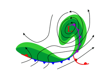
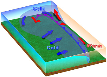
If you track low-pressure areas and temperature gradients where fronts form, especially in winter, you will often notice that these systems undergo a particular cycle. This cycle results in what are called mid-latitude or extratropical cyclones, which drive weather across the globe from fall to spring.
The Norwegian cyclone model is named to honor Norwegian meteorologists who first conceptualized the typical life cycle of these cyclones in the 1910s and 1920s.
Initial Condition
In this model, there will initially be a boundary, or front, separating warm air to the south from cold air to the north. The front is often stationary.
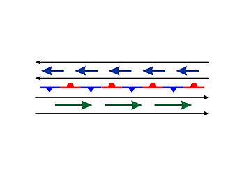
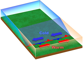
Beginning Stage
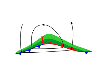
A wave develops on the front when an upper-level low pressure system, embedded in the jet stream, moves over the front. The front develops a "kink" where the wave is developing, and the stationary front transitions into a cold front and warm front as the air masses begin to move. Precipitation will begin to develop, with the heaviest occurrence along the front (dark green in the weather map view below).

Intensification
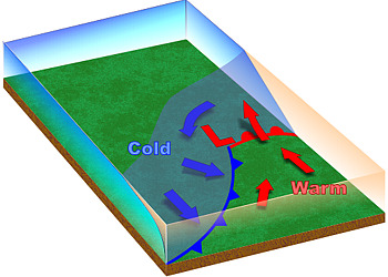
As the wave intensifies, both cold and warm fronts become better organized, typically marked by a sharper temperature gradient and a distinct change in wind direction.

Mature Stage
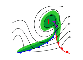
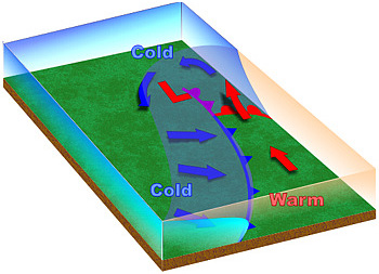
The wave becomes a mature low-pressure system. The cold front, which moves faster than the warm front, "catches up" with the warm front and overtakes it, forming an occluded front (purple line in the maps below).
Dissipation
As the cold front continues advancing on the warm front, the occlusion increases, progressively removing the warm moist air from the center of the low pressure system. Without the warm air mass to maintain it, the low-pressure system gradually dissipates.
