In July, over 60 residents of Cumberland County, Maine, packed into a room in the local Cliff Island Post Office. There, the Gulf of Maine Research Institute (GMRI) led them through an exploration of Maine’s climate past, using it as an entry point to help the residents better understand their state’s climate present and future.

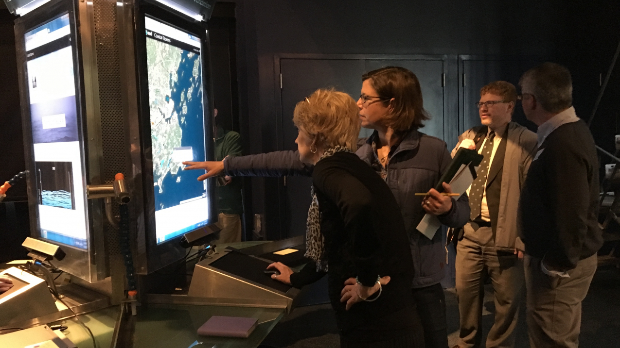
Through programs at the Gulf of Maine Research Institute's Interactive Learning Laboratory and in community centers throughout the state, GMRI engages the public in exploring and understanding local climate impacts. (Image credit: Gayle Bowness)
Most people in Maine, including the attendees of this event, live along the Gulf of Maine, where coastal waters have warmed offsite link more than anywhere else in the United States. This warming water and the ensuing sea level rise contribute to severe storms and king tides (the highest high tides of the year) that hurt the community’s residents, industries, and ecosystems.
To help Maine residents understand and prepare for these threats, GMRI sought out assistance from NOAA’s Environmental Literacy Program (ELP), which supports the use of education as a tool to help people and their communities become more resilient to extreme weather and climate events. Through an ELP grant, GMRI created an interactive learning experience called “Preparing coastal communities for sea level rise.” This program integrated NOAA data into story maps — interactive digital tools that combine geographic data and narrative — to engage people in understanding sea level rise, its causes, its future projections, and its impacts on local communities.
In the Cliff Island Post Office, residents used this data to investigate how past weather events had impacted their community. They pulled up information on a Nor’easter known as the Patriots Day Storm of 2007, which caused a 2.7-foot storm surge and 13.3-foot storm tide that flooded their coastline. They then looked at current sea level rise data to identify areas of local risk and prepare to be more resilient against similar threats moving forward. By encouraging residents to evaluate the resiliency of their own communities, GMRI empowered individuals to take an active approach to creating an informed and prepared community.
Over the course of the project, GMRI worked with more than 2,000 Mainers to improve their awareness, knowledge, and understanding of sea level rise and its implications for Maine’s coastal communities. Both of GMRI's municipal partners, Portland and South Portland, have embarked on developing a new Climate Adaptation and Action Plan, that will reduce greenhouse gas emissions offsite link by 80% by 2050 and build more resilient communities. GMRI is a key partner in assessing coastal flood vulnerabilities due to sea level rise and storm surge and community engagement in that data.
“We all need to be involved, in every sector of [our communities],” said Troy Moon, Portland’s sustainability coordinator. “We need everyone at the table to figure out how [to make our cities more resilient as the climate changes].” Thanks to GMRI and NOAA’s Environmental Literacy Program, more Maine residents now have a seat at the resiliency planning table.
This story was originally published in the Fiscal Year 2018 NOAA Education Accomplishments Report.
UPDATE: This story was revised on December 11, 2019, to incorporate updated information from the Gulf of Maine Research Institute. The number of people reached through the program was updated from 1,200 to 2,000, and the roles of the partners around the Climate Adaptation and Action Plan was corrected.


