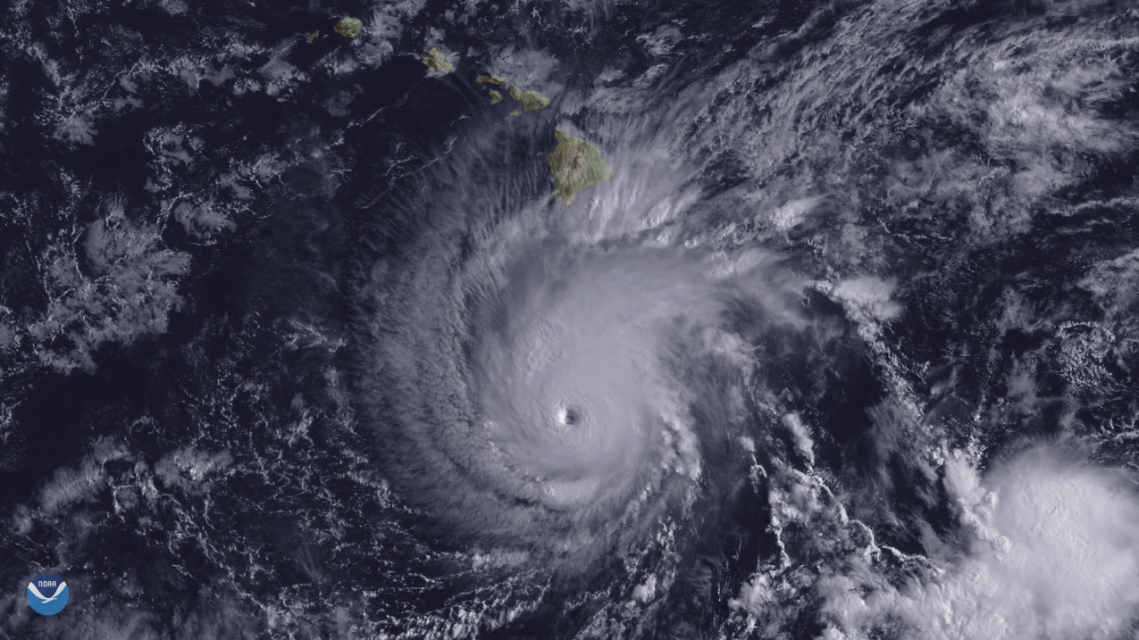
Five years ago, Hurricane Lane, a category 5 hurricane passed within 150 miles of the Main Hawaiian Islands. It set the state record for tropical cyclone rainfall (58 inches) and caused over $7 million in damage. Image from NOAA’s GOES-West satellite, August 22, 2018. (Image credit: NOAA)
There is a 50% chance of above-normal tropical cyclone activity during the central Pacific hurricane season this year, according to the outlook from NOAA’s Central Pacific Hurricane Center and NOAA’s Climate Prediction Center, divisions of the National Weather Service. The outlook also indicates a 35% chance for near-normal activity, and only a 15% chance of a below-normal hurricane season.
For the 2023 season, 4 to 7 tropical cyclones are predicted for the central Pacific hurricane region, which is located north of the equator between 140°W and the International Date Line. A near-normal season has 4 or 5 tropical cyclones. Tropical cyclones include tropical depressions, tropical storms and hurricanes.
“Hurricane season in the central Pacific region is expected to be slightly busier this year, compared to a normal season,” said Matthew Rosencrans, NOAA’s lead seasonal hurricane forecaster at the Climate Prediction Center. “A key factor influencing our forecast is the predicted arrival of El Nino this summer, which typically contributes to an increase in tropical cyclone activity across the Pacific Ocean basin.”
The outlook is a general guide to the overall seasonal tropical cyclone activity in the central Pacific basin, and does not predict whether or how many of these systems will affect Hawaii. The central Pacific hurricane season begins June 1 and runs through November 30.
“The last few hurricane seasons have been pretty quiet around Hawaii, luring some folks to let their guard down. Now it’s looking like this season will be more active than the past several years,” said Chris Brenchley, director of NOAA’s Central Pacific Hurricane Center. “It’s more important than ever to review your emergency plan and supply kit now, so you will be prepared for the next hurricane threat.”
The Central Pacific Hurricane Center continuously monitors weather conditions using satellites, land-and ocean-based sensors and aircraft reconnaissance missions operated by NOAA and its partners. These observations are fed into complex computer models that run on NOAA’s supercomputers. Forecasters at the Center use that information to develop storm track and intensity forecasts and provide critical decision support services to emergency managers at the federal, state and county levels.
Supercomputing and forecast improvements
- This summer, NOAA will increase its supercomputing capacity by 20%, allowing for more detailed, higher-resolution forecast models, advanced physics and improved data assimilation. Once implemented, the computing system will be able to perform 29 quadrillion calculations per second. The expansion will allow for forecast model upgrades for years to come, starting with the Hurricane Analysis and Forecast System.
- The Central Pacific Hurricane Center will extend the forecast range of the Tropical Weather Outlook from five to seven days this season. The seven-day outlook will provide emergency managers and communities with more time to prepare for tropical activity and creates a seamless suite of products when combined with the two-week Global Tropical Hazards Outlook from the Climate Prediction Center.
Check for watches and warnings on the Central Pacific Hurricane Center’s website throughout the season, and visit FEMA’s Ready.gov for additional hurricane preparedness tips.
Media contact
John Bravender, National Weather Service, john.bravender@noaa.gov, (808) 973-5275


