NOAA ships and planes trading cards: Collect them all!

NOAA’s work to understand our dynamic planet often involves sending people into the atmosphere and out to sea to conduct important research. From “Hurricane Hunter” aircraft that pilots fly directly into hurricanes to fisheries survey vessels that run quietly to avoid disturbing marine life, the Office of Marine and Aviation Operations maintains and operates a fleet of specialized research vessels and aircraft

Get to know NOAA’s ships and planes with these virtual trading cards! 

Planes

Beechcraft King Air 350CER
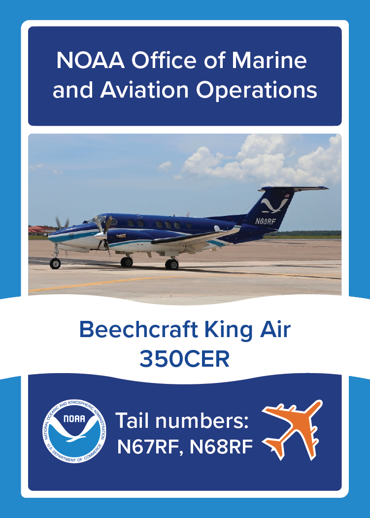
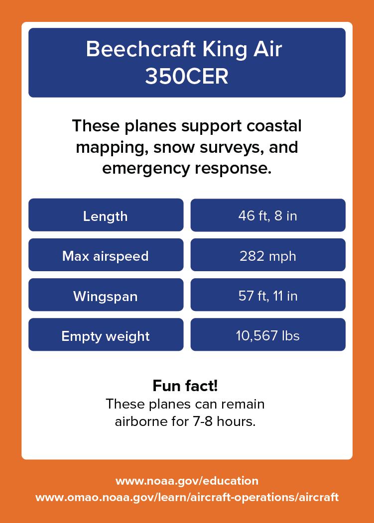
Beechcraft King Air 350CER. These planes support coastal mapping, snow surveys, and emergency response. Length: 46 feet, 8 inches. Max airspeed: 282 miles per hour. Wingspan: 57 feet, 11 inches. Empty weight: 10,567 pounds. Fun fact! These planes can remain airborne for 7-8 hours. www.noaa.gov/education. www.omao.noaa.gov/learn/aircraft-operations/aircraft.
Front
Beechcraft King Air 350CER. These planes support coastal mapping, snow surveys, and emergency response. Length: 46 feet, 8 inches. Max airspeed: 282 miles per hour. Wingspan: 57 feet, 11 inches. Empty weight: 10,567 pounds. Fun fact! These planes can remain airborne for 7-8 hours. www.noaa.gov/education. www.omao.noaa.gov/learn/aircraft-operations/aircraft.
Back

About

These planes support coastal mapping, snow surveys, and emergency response.

  • Length: 46 feet, 8 inches.
  • Max airspeed: 282 miles per hour.
  • Wingspan: 57 feet, 11 inches.
  • Empty weight: 10,567 pounds.

Fun fact!

These planes can remain airborne for 7-8 hours. Learn more about the Beechcraft King Air 350CER.

De Havilland DHC-6-300 Twin Otter
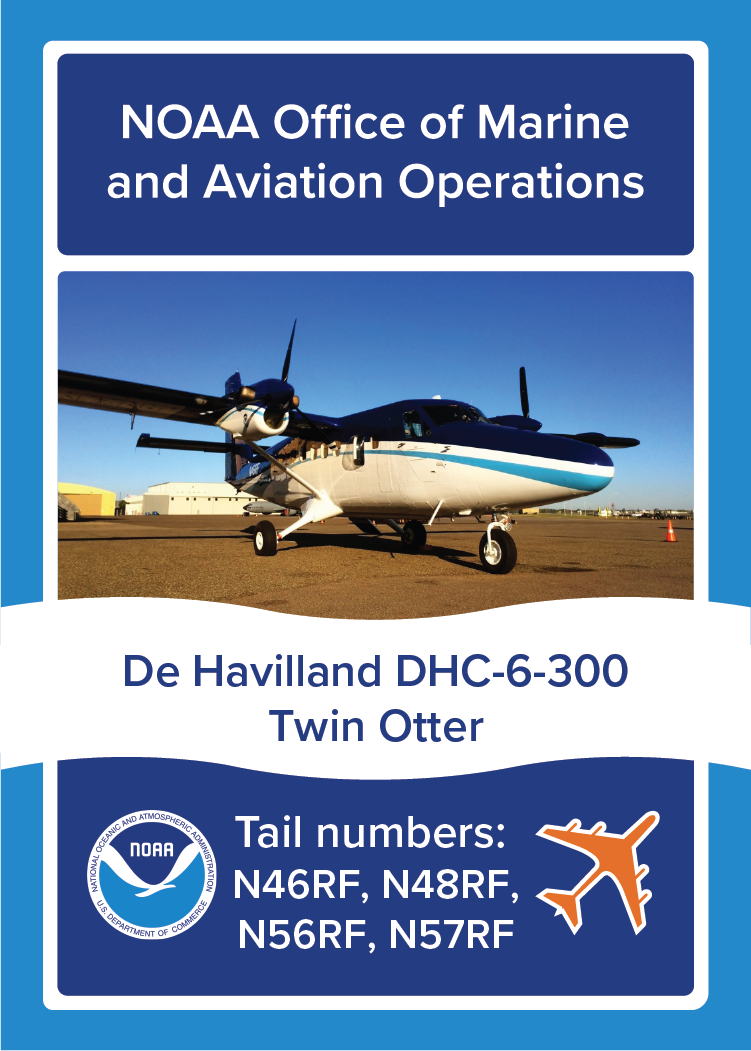
NOAA Plane De Havilland DHC-6-300 Twin Otter, NOAA Office of Marine and Aviation Operations, Tail numbers: N46RF, N48RF, N56RF,N57RF. Image: Photo of NOAA Plane De Havilland DHC-6-300 Twin Otter on the ground.
Front
De Havilland DHC-6-300 Twin Otter. These planes support marine mammal, coastal mapping, and snow surveys. Length: 51 feet, 9 inches. Max airspeed: 172 miles per hour. Wingspan: 65 feet. Empty weight: 8,100 pounds. Fun fact! These planes can cover over 600 nautical miles of survey in a single fuel load. www.noaa.gov/education. www.omao.noaa.gov/learn/aircraft-operations/aircraft.
Back

About

These planes support marine mammal, coastal mapping, and snow surveys.

  • Length: 51 feet, 9 inches.
  • Max airspeed: 172 miles per hour.
  • Wingspan: 65 feet.
  • Empty weight: 8,100 pounds. 

Fun fact!

These planes can cover over 600 nautical miles of survey in a single fuel load. Learn more about the De Havilland DHC-6-300 Twin Otters

Gulfstream IV-SP

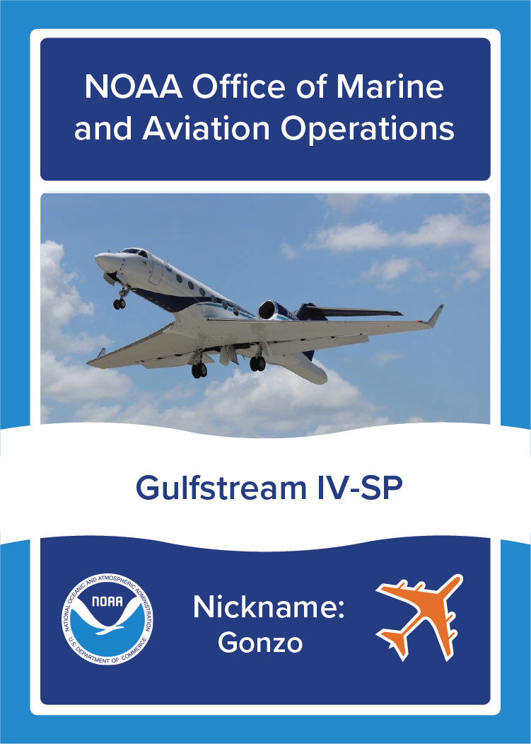
NOAA Plane Gulfstream IV-SP, NOAA Office of Marine and Aviation Operations, Nickname: Gonzo. Image: Photo of NOAA Plane Gulfstream IV-SP in flight.
Front
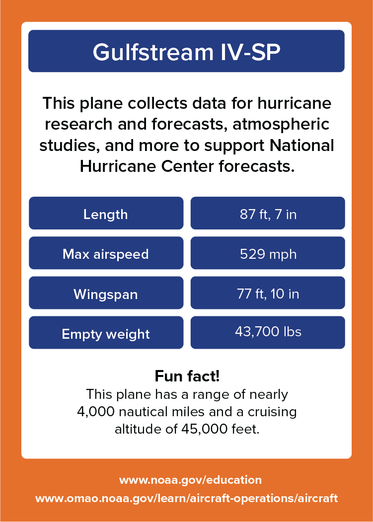
Gulfstream IV-SP. This plane collects data for hurricane research and forecasts, atmospheric studies, and more to support National Hurricane Center forecasts. Length: 87 feet, 7 inches. Max airspeed: 529 miles per hour. Wingspan: 77 feet, 10 inches. Empty weight: 43,700 pounds. Fun fact! This plane has a range of nearly 4,000 nautical miles and a cruising altitude of 45,000 feet. www.noaa.gov/education. www.omao.noaa.gov/learn/aircraft-operations/aircraft.
Back

About

This plane collects data for hurricane research and forecasts, atmospheric studies, and more to support National Hurricane Center forecasts.

  • Length: 87 feet, 7 inches.
  • Max airspeed: 529 miles per hour.
  • Wingspan: 77 feet, 10 inches.
  • Empty weight: 43,700 pounds. 

Fun fact!

This plane has a range of nearly 4,000 nautical miles and a cruising altitude of 45,000 feet. Learn more about the Gulfstream IV-SP

Gulfstream Turbo Commander AC-695A (Decommissioned)

NOAA Plane Gulfstream Turbo Commander AC-695A [Decommissioned], NOAA Office of Marine and Aviation Operations, Tail number: N45RF. Image: Photo of NOAA Plane Gulfstream Turbo Commander AC-695A in flight.
Front
Gulfstream Turbo Commander AC-695A. This plane collected data for flooding forecasts and water resource management as well as emergency response tasks. Length: 87 feet, 6 inches. Max airspeed: 287 miles per hour. Wingspan: 43 feet. Empty weight: 7,300 pounds. Fun fact! This plane would fly low over snow covered regions to measure the water content of the snowpack below. www.noaa.gov/education. www.omao.noaa.gov/learn/aircraft-operations/aircraft.
Back

About

This plane collected data for flooding forecasts and water resource management as well as emergency response tasks.

  • Length: 87 feet, 6 inches.
  • Max airspeed: 287 miles per hour.
  • Wingspan: 43 feet.
  • Empty weight: 7,300 pounds. 

Fun fact!

This plane would fly low over snow covered regions to measure the water content of the snowpack below. It was decommissioned in 2021. 

Lockheed WP-3D Orion
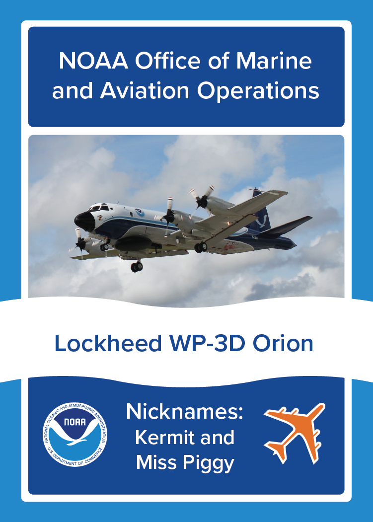
NOAA Plane Lockheed WP-3D Orion, NOAA Office of Marine and Aviation Operations, Nicknames: Kermit and Miss Piggy. Image: Photo of NOAA Plane Lockheed WP-3D Orion in flight.
Front
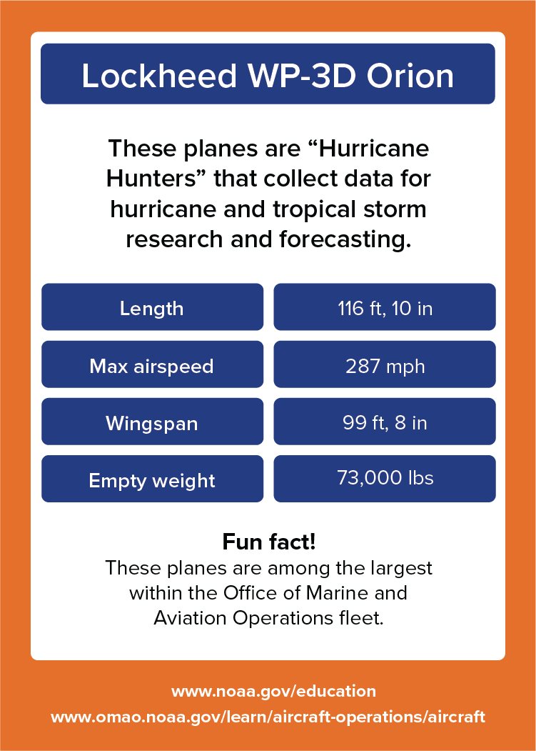
Lockheed WP-3D Orion. These planes are “Hurricane Hunters” that collect data for hurricane and tropical storm research and forecasting. Length: 116 feet, 10 inches. Max airspeed: 287 miles per hour. Wingspan: 99 feet, 8 inches. Empty weight: 73,000 pounds. Fun fact! These planes are among the largest within the Office of Marine and Aviation Operations fleet. www.noaa.gov/education. www.omao.noaa.gov/learn/aircraft-operations/aircraft.
Back

About

These planes are “Hurricane Hunters” that collect data for hurricane and tropical storm research and forecasting.

  • Length: 116 feet, 10 inches.
  • Max airspeed: 287 miles per hour.
  • Wingspan: 99 feet, 8 inches.
  • Empty weight: 73,000 pounds. 

Fun fact!

These planes are among the largest within the Office of Marine and Aviation Operations fleet. Learn more about the Lockheed WP-3D Orion aircraft

Ships

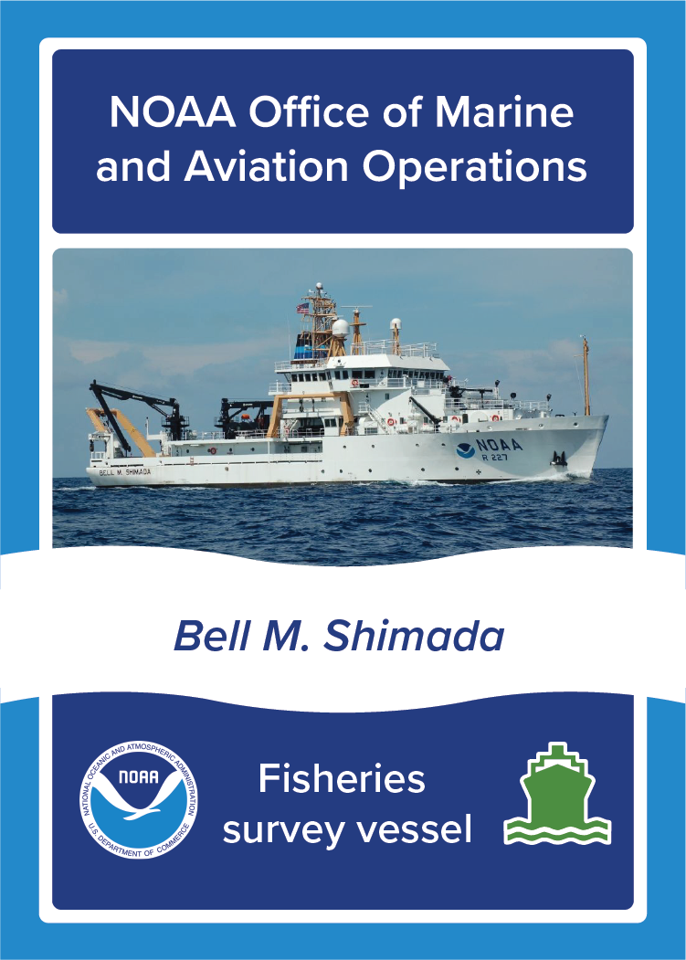
Bell M. Shimada

NOAA Ship Bell M. Shimada, NOAA Office of Marine and Aviation Operations, Fisheries survey vessel. Image: Photo of NOAA Ship Bell M. Shimada at sea.
Front
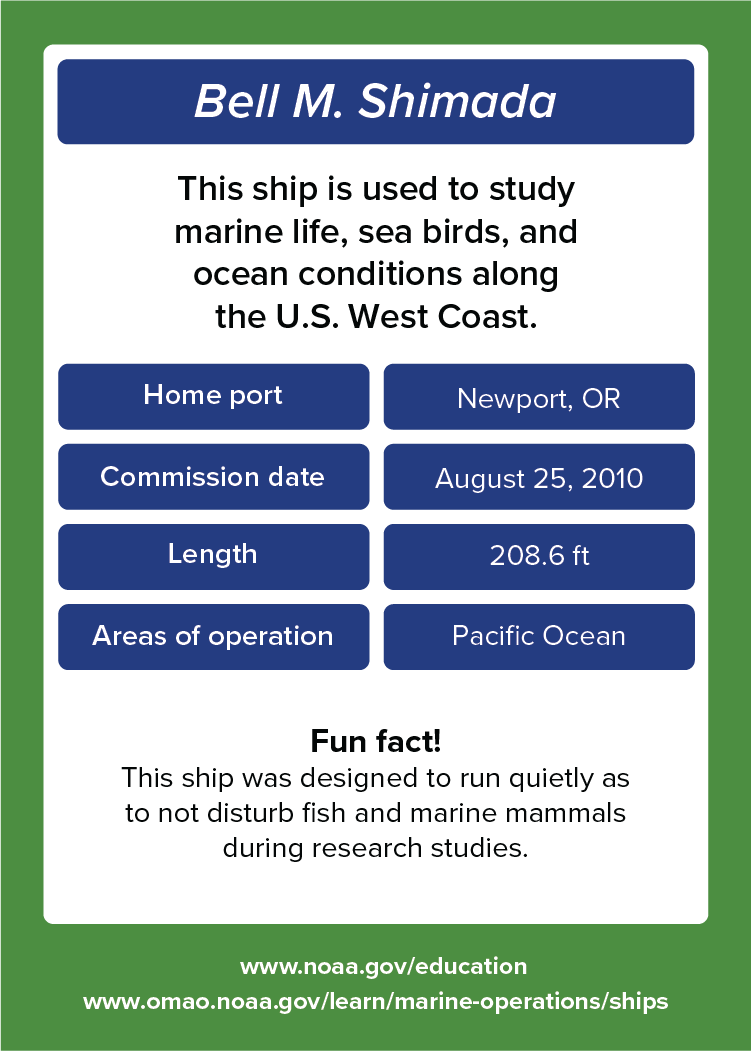
Bell M. Shimada. This ship is used to study marine life, sea birds, and ocean conditions along the U.S. West Coast. Home port: Newport, OR. Commission date: August 25, 2010. Length: 208.6 feet. Areas of operation: Pacific Ocean. Fun fact! This ship was designed to run quietly as to not disturb fish and marine mammals during research studies. www.noaa.gov/education. www.omao.noaa.gov/learn/marine-operations/ships.
Back

About

This ship is used to study marine life, sea birds, and ocean conditions along the U.S. West Coast.

  • Home port: Newport, OR.
  • Commission date: August 25, 2010.
  • Length: 208.6 feet.
  • Areas of operation: Pacific Ocean.

Fun fact!

This ship was designed to run quietly as to not disturb fish and marine mammals during research studies. Learn more about NOAA Ship Bell M. Shimada.

Fairweather
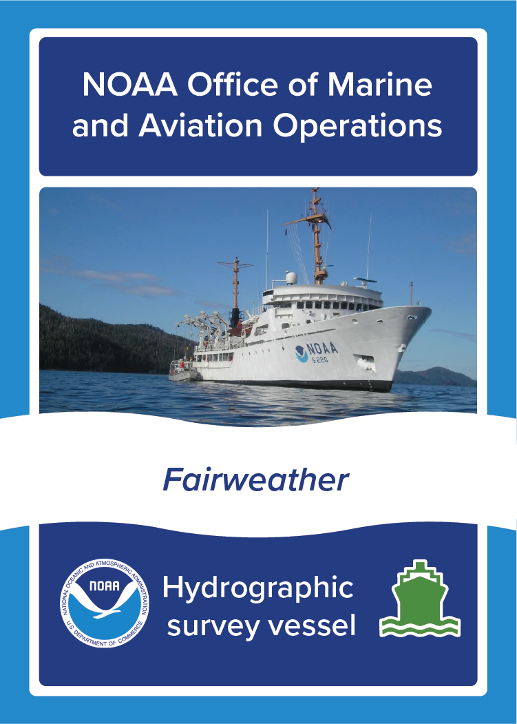
NOAA Ship Fairweather, NOAA Office of Marine and Aviation Operations, Hydrographic survey vessel. Image: Photo of NOAA Ship Fairweather at sea.
Front
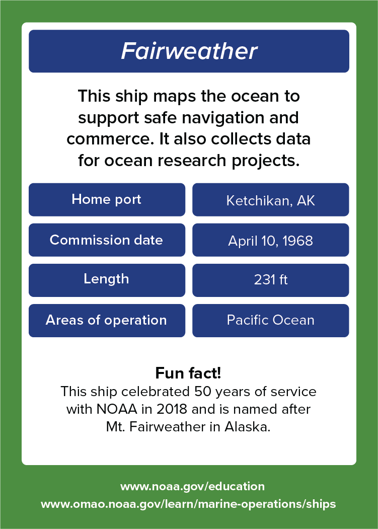
Fairweather. This ship maps the ocean to support safe navigation and commerce. It also collects data for ocean research projects. Home port: Ketchikan, AK. Commission date: April 10, 1968. Length: 231 feet. Areas of operation: Pacific Ocean. Fun fact! This ship celebrated 50 years of service with NOAA in 2018 and is named after Mt. Fairweather in Alaska. www.noaa.gov/education. www.omao.noaa.gov/learn/marine-operations/ships.
Back

About

This ship maps the ocean to support safe navigation and commerce. It also collects data for ocean research projects.

  • Home port: Ketchikan, AK.
  • Commission date: April 10, 1968.
  • Length: 231 feet.
  • Areas of operation: Pacific Ocean. 

Fun fact!

This ship celebrated 50 years of service with NOAA in 2018 and is named after Mt. Fairweather in Alaska. Learn more about NOAA Ship Fairweather

Ferdinand R. Hassler

NOAA Ship Ferdinand R. Hassler, NOAA Office of Marine and Aviation Operations, Hydrographic survey vessel. Image: Photo of NOAA Ship Ferdinand R. Hassler at sea.
Front
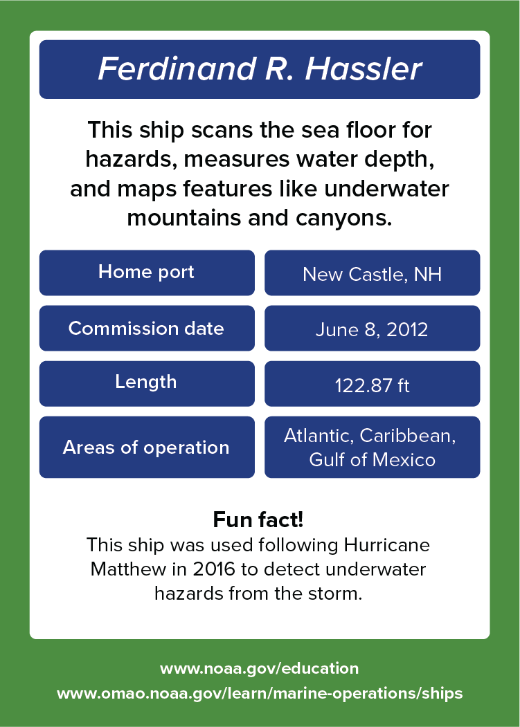
Ferdinand R. Hassler. This ship scans the sea floor for hazards, measures water depth, and maps features like underwater mountains and canyons. Home port: New Castle, NH. Commission date: June 8, 2012. Length: 122.87 feet. Areas of operation: Atlantic, Caribbean, Gulf of Mexico. Fun fact! This ship was used following Hurricane Matthew in 2016 to detect underwater hazards from the storm. www.noaa.gov/education. www.omao.noaa.gov/learn/marine-operations/ships.
Back

About

This ship scans the sea floor for hazards, measures water depth, and maps features like underwater mountains and canyons.

  • Home port: New Castle, NH.
  • Commission date: June 8, 2012.
  • Length: 122.87 feet.
  • Areas of operation: Atlantic, Caribbean, Gulf of Mexico. 

Fun fact!

This ship was used following Hurricane Matthew in 2016 to detect underwater hazards from the storm. Learn more about NOAA Ship Ferdinand R. Hassler.

Gordon Gunter

NOAA Ship Gordon Gunter, NOAA Office of Marine and Aviation Operations, Oceanographic survey vessel. Image: Photo of NOAA Ship Gordon Gunter at sea.
Front
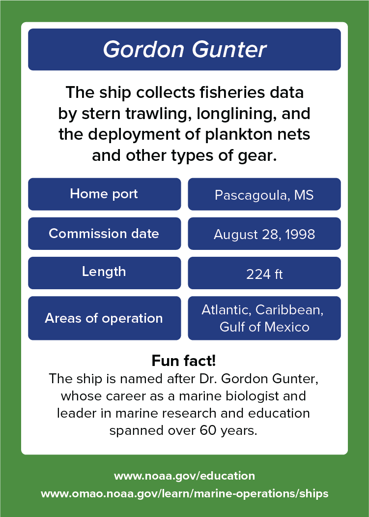
Gordon Gunter. This ship collects fisheries data by stern trawling, longlining, and the deployment of plankton nets and other types of gear. Home port: Pascagoula, MS. Commission date: August 28, 1998. Length: 224 feet. Areas of operation: Atlantic, Caribbean, Gulf of Mexico. Fun fact! This ship is named after Dr. Gordon Gunter, whose career as a marine biologist and leader in marine research and education spanned over 60 years. www.noaa.gov/education. www.omao.noaa.gov/learn/marine-operations/ships.
Back

About

This ship collects fisheries data by stern trawling, longlining, and the deployment of plankton nets and other types of gear.

  • Home port: Pascagoula, MS.
  • Commission date: August 28, 1998.
  • Length: 224 feet.
  • Areas of operation: Atlantic, Caribbean, Gulf of Mexico. 

Fun fact!

This ship is named after Dr. Gordon Gunter, whose career as a marine biologist and leader in marine research and education spanned over 60 years. Learn more about NOAA Ship Gordon Gunter

Henry B. Bigelow

NOAA Ship Henry B. Bigelow, NOAA Office of Marine and Aviation Operations, Fisheries survey vessel. Image: Photo of NOAA Ship Henry B. Bigelow at sea.
Front
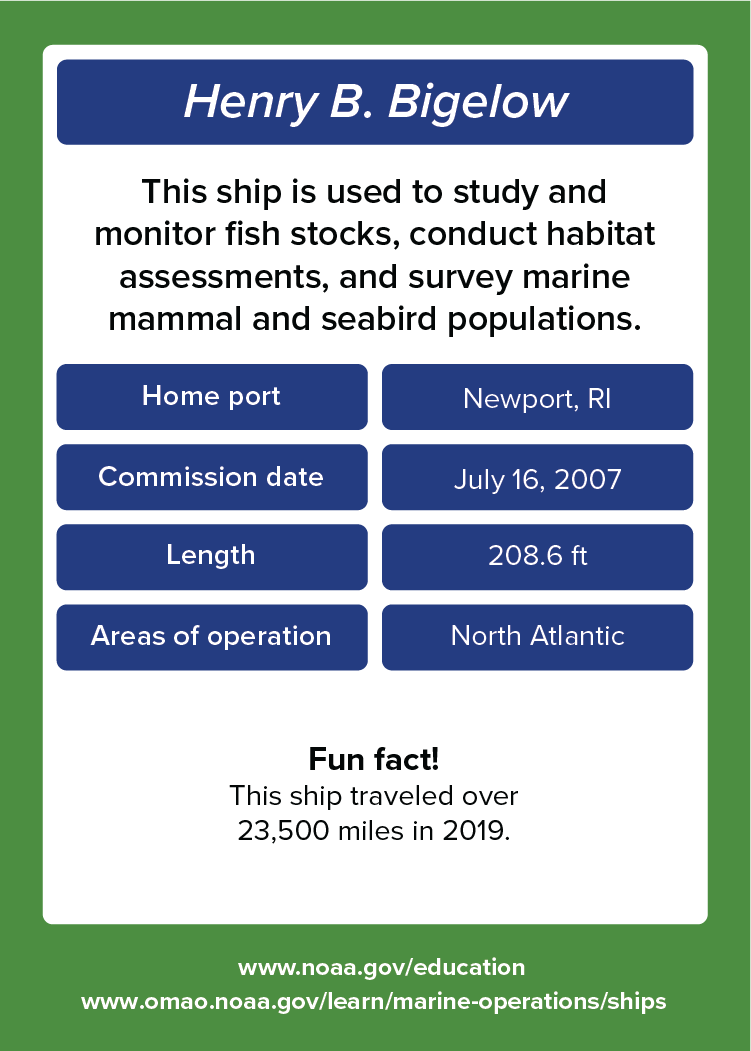
Henry B. Bigelow. This ship is used to study and monitor fish stocks, conduct habitat assessments, and survey marine mammal and seabird populations. Home port: Newport, RI. Commission date: July 16, 2007. Length: 208.6 feet. Areas of operation: North Atlantic. Fun fact! The ship traveled over 23,500 miles in 2019. www.noaa.gov/education. www.omao.noaa.gov/learn/marine-operations/ships.
Back

About

This ship is used to study and monitor fish stocks, conduct habitat assessments, and survey marine mammal and seabird populations.

  • Home port: Newport, RI.
  • Commission date: July 16, 2007.
  • Length: 208.6 feet.
  • Areas of operation: North Atlantic. 

Fun fact!

The ship traveled over 23,500 miles in 2019. Learn more about NOAA Ship Henry B. Bigelow. 

Nancy Foster
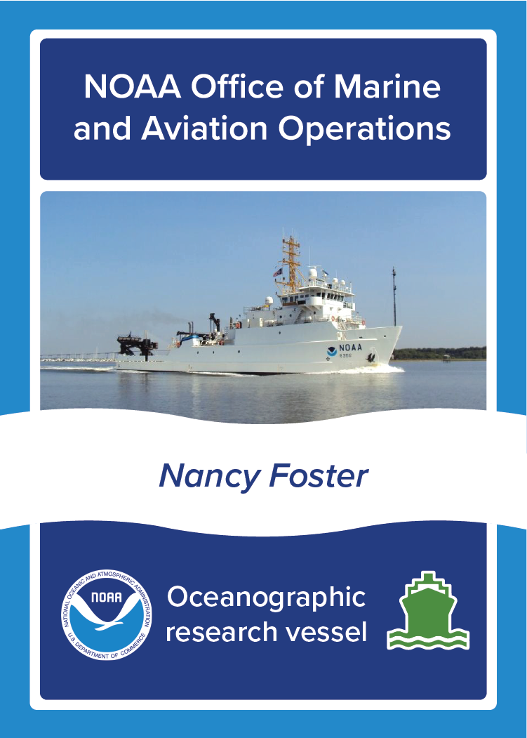
NOAA Ship Nancy Foster, NOAA Office of Marine and Aviation Operations, Oceanographic survey vessel. Image: Photo of NOAA Ship Nancy Foster at sea.
Front
Nancy Foster. This ship supports fish habitat and population studies as well as seafloor mapping surveys. Home port: Charleston, SC. Commission date: May 10, 2004. Length: 187 feet. Areas of operation: Atlantic, Caribbean, Gulf of Mexico. Fun fact! This ship was named for Dr. Nancy Foster, who led several NOAA programs to explore, map, protect, and sustainably develop coastal and fishery resources. www.noaa.gov/education. www.omao.noaa.gov/learn/marine-operations/ships.
Back

About

This ship supports fish habitat and population studies as well as seafloor mapping surveys.

  • Home port: Charleston, SC.
  • Commission date: May 10, 2004.
  • Length: 187 feet.
  • Areas of operation: Atlantic, Caribbean, Gulf of Mexico. 

Fun fact!

This ship was named for Dr. Nancy Foster, who led several NOAA programs to explore, map, protect, and sustainably develop coastal and fishery resources. Learn more about NOAA Ship Nancy Foster

Okeanos Explorer

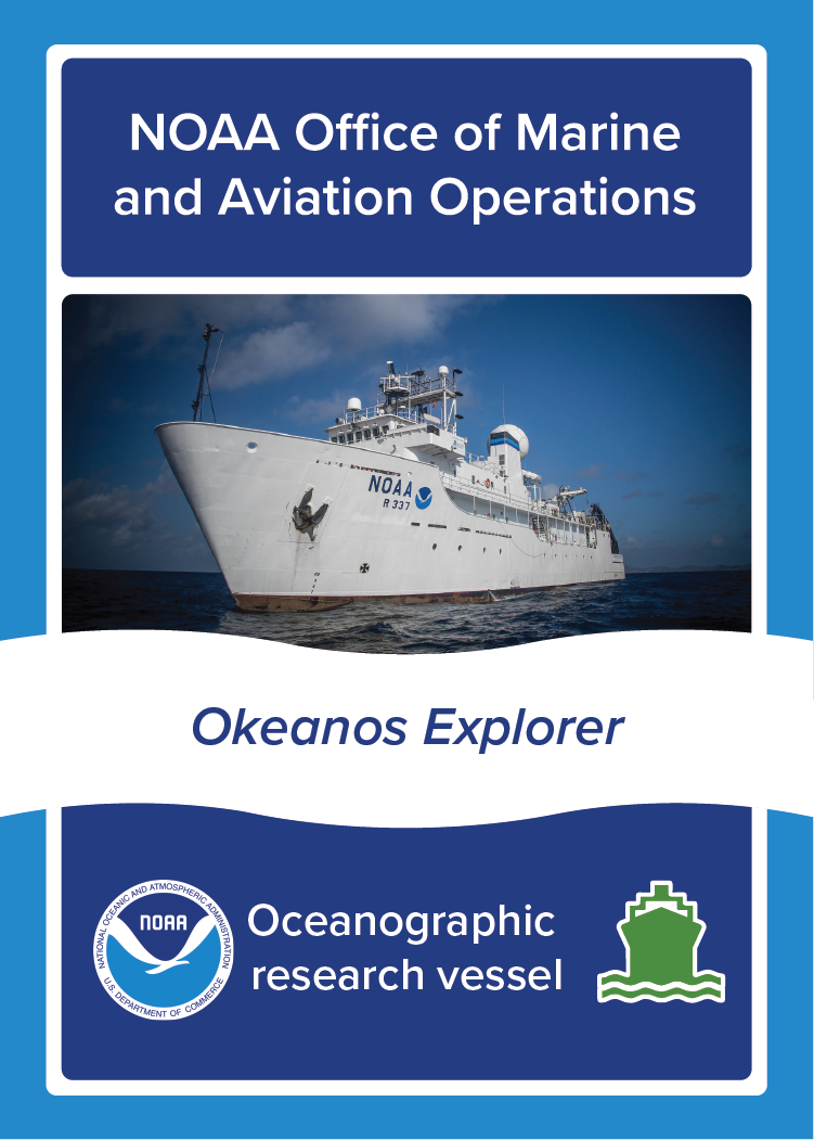
NOAA Ship Okeanos Explorer, NOAA Office of Marine and Aviation Operations, Oceanographic survey vessel. Image: Photo of NOAA Ship Okeanos Explorer at sea.
Front
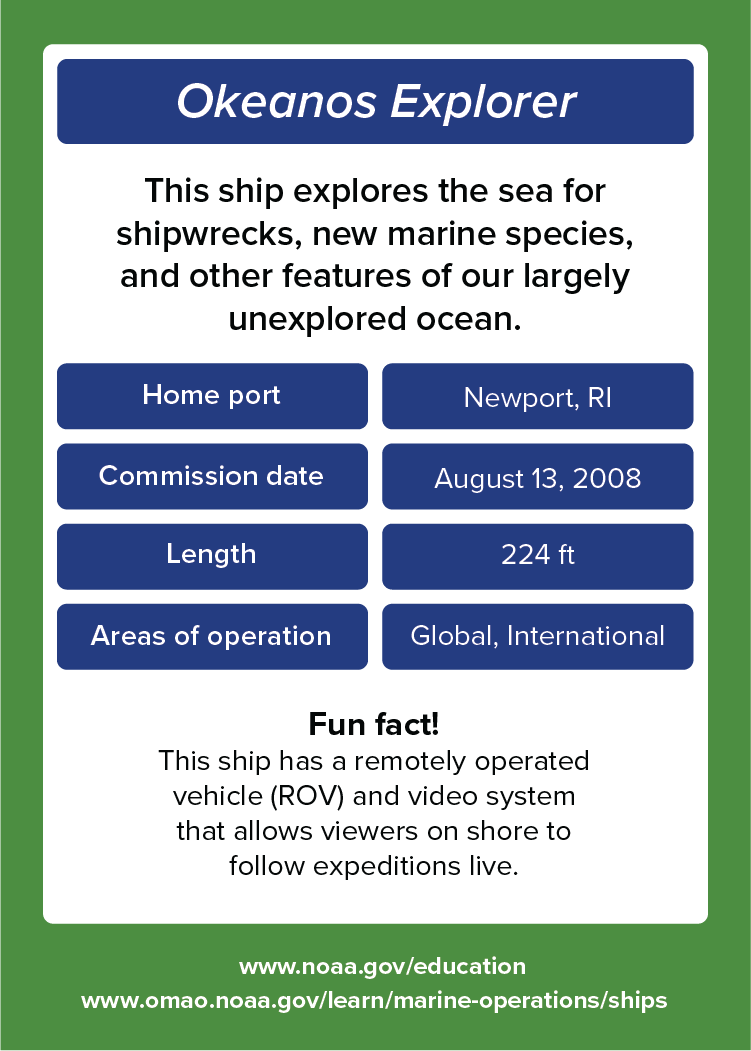
Okeanos Explorer. This ship explores the sea for shipwrecks, new marine species, and other features of our largely unexplored ocean. Home port: Newport, RI. Commission date: August 13, 2008. Length: 224 feet. Areas of operation: Global, International. Fun fact! This ship has a remotely operated vehicle (ROV) and video system that allows viewers on shore to follow expeditions live. www.noaa.gov/education. www.omao.noaa.gov/learn/marine-operations/ships.
Back

About

This ship explores the sea for shipwrecks, new marine species, and other features of our largely unexplored ocean.

  • Home port: Newport, RI.
  • Commission date: August 13, 2008.
  • Length: 224 feet.
  • Areas of operation: Global, International. 

Fun fact!

This ship has a remotely operated vehicle (ROV) and video system that allows viewers on shore to follow expeditions live. Learn more about NOAA Ship Okeanos Explorer

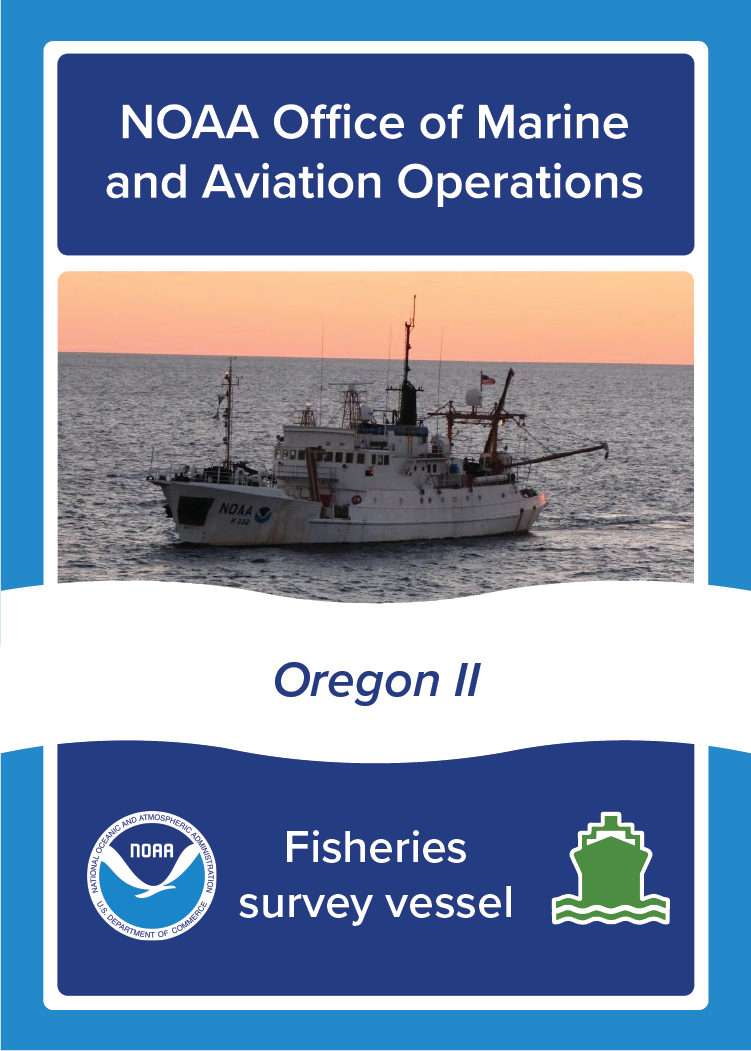
Oregon II

NOAA Ship Oregon II, NOAA Office of Marine and Aviation Operations, Fisheries survey vessel. Image: Photo of NOAA Ship Oregon II at sea.
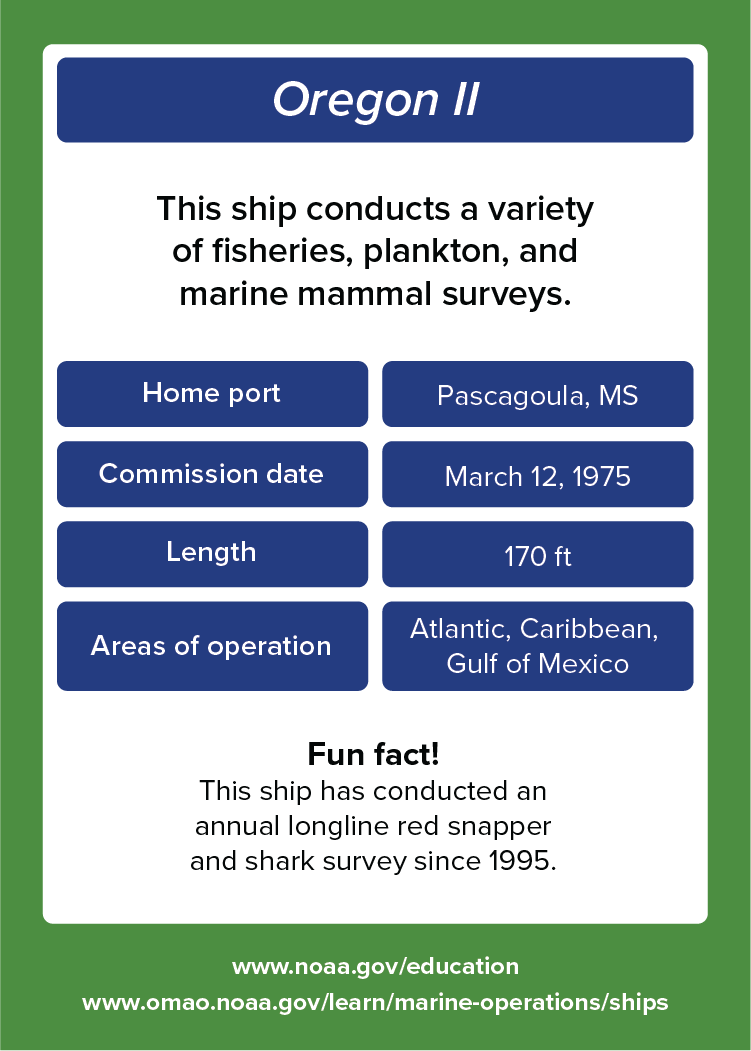
Front
Oregon II. This ship conducts a variety of fisheries plankton, and marine mammal surveys. Home port: Pascagoula, MS. Commission date: March 12, 1975. Length: 170 feet. Areas of operation: Atlantic, Caribbean, Gulf of Mexico. Fun fact! This ship has conducted an annual longline red snapper and shark survey since 1995. www.noaa.gov/education. www.omao.noaa.gov/learn/marine-operations/ships.
Back

About

This ship conducts a variety of fisheries plankton, and marine mammal surveys.

  • Home port: Pascagoula, MS.
  • Commission date: March 12, 1975.
  • Length: 170 feet.
  • Areas of operation: Atlantic, Caribbean, Gulf of Mexico. 

Fun fact!

This ship has conducted an annual longline red snapper and shark survey since 1995. Learn more about NOAA Ship Oregon II

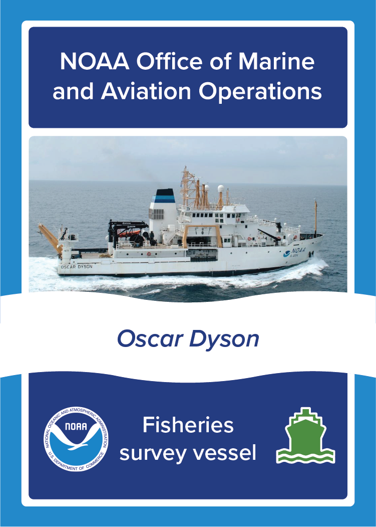
Oscar Dyson

NOAA Ship Oscar Dyson, NOAA Office of Marine and Aviation Operations, Fisheries survey vessel. Image: Photo of NOAA Ship Oscar Dyson at sea.
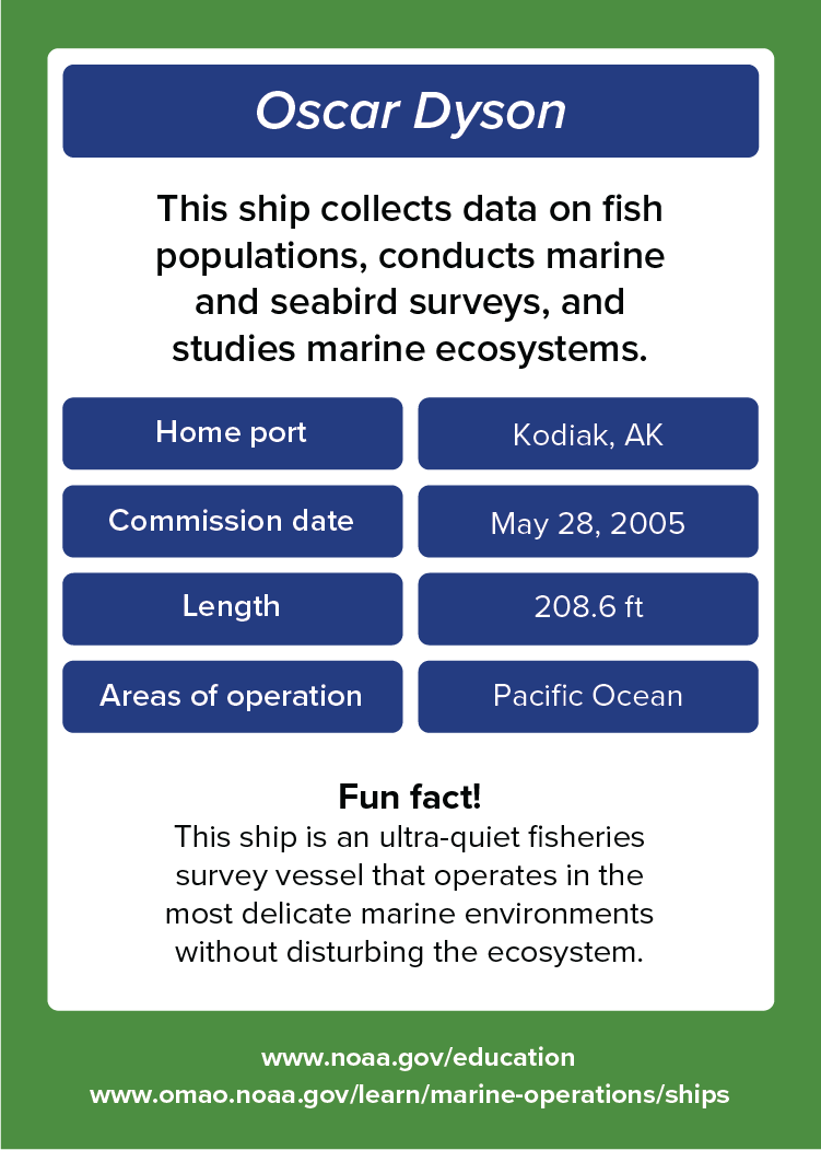
Front
Oscar Dyson. This ship collects data on fish populations, conducts marine and seabird surveys, and studies marine ecosystems. Home port: Kodiak, AK. Commission date: May 28, 2005. Length: 208.6 feet. Areas of operation: Pacific Ocean. Fun fact! This ship is an ultra-quiet fisheries survey vessel that operates in the most delicate marine environments without disturbing the ecosystem. www.noaa.gov/education. www.omao.noaa.gov/learn/marine-operations/ships.
Back

About

This ship collects data on fish populations, conducts marine and seabird surveys, and studies marine ecosystems.

  • Home port: Kodiak, AK.
  • Commission date: May 28, 2005.
  • Length: 208.6 feet.
  • Areas of operation: Pacific Ocean. 

Fun fact!

This ship is an ultra-quiet fisheries survey vessel that operates in the most delicate marine environments without disturbing the ecosystem. Learn more about NOAA Ship Oscar Dyson

Oscar Elton Sette

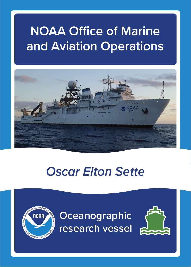
NOAA Ship Oscar Elton Sette, NOAA Office of Marine and Aviation Operations, Oceanographic survey vessel. Image: Photo of NOAA Ship Oscar Elton Sette at sea.
Front
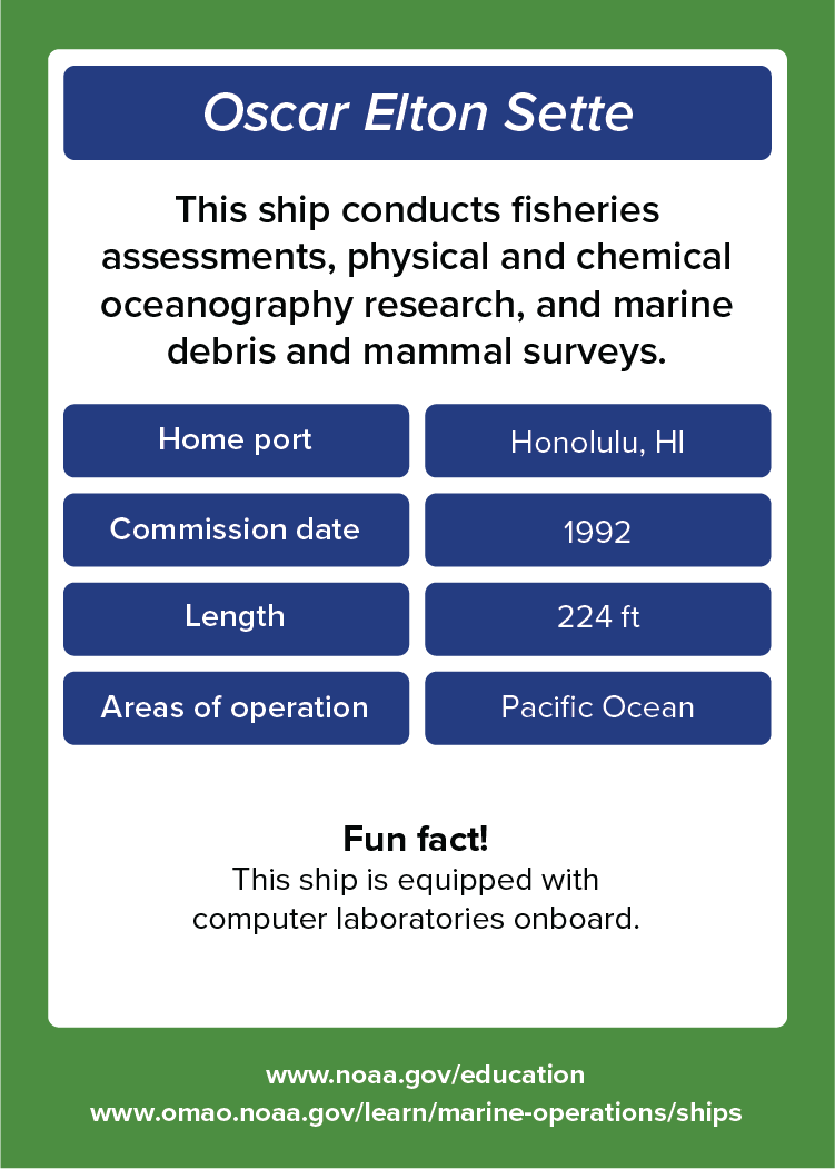
Oscar Elton Sette. This ship conducts fisheries assessments, physical and chemical oceanography research, and marine debris and mammal surveys. Home port: Honolulu, HI. Commission date: 1992. Length: 224 feet. Areas of operation: Pacific Ocean. Fun fact! This ship is equipped with computer laboratories onboard. www.noaa.gov/education. www.omao.noaa.gov/learn/marine-operations/ships.
Back

About

This ship conducts fisheries assessments, physical and chemical oceanography research, and marine debris and mammal surveys.

  • Home port: Honolulu, HI.
  • Commission date: 1992.
  • Length: 224 feet.
  • Areas of operation: Pacific Ocean. 

Fun fact!

This ship is equipped with computer laboratories onboard. Learn more about NOAA Ship Oscar Elton Sette

Pisces

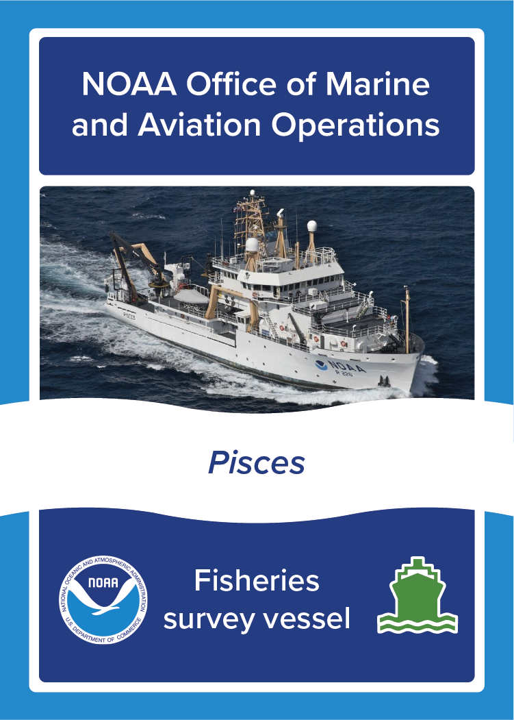
NOAA Ship Pisces, NOAA Office of Marine and Aviation Operations, Fisheries survey vessel. Image: Photo of NOAA Ship Pisces at sea.
Front
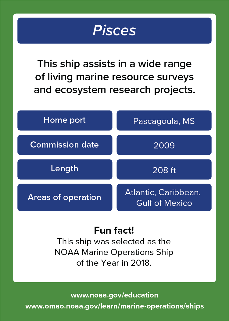
Pisces. This ship assists in a wide range of living marine resource surveys and ecosystem research projects. Home port: Pascagoula, MS. Commission date: 2009. Length: 208 feet. Areas of operation: Atlantic, Caribbean, Gulf of Mexico. Fun fact! This ship was selected as the NOAA Marine Operations Ship of the Year in 2018. www.noaa.gov/education. www.omao.noaa.gov/learn/marine-operations/ships.
Back

About

This ship assists in a wide range of living marine resource surveys and ecosystem research projects.

  • Home port: Pascagoula, MS.
  • Commission date: 2009.
  • Length: 208 feet.
  • Areas of operation: Atlantic, Caribbean, Gulf of Mexico. 

Fun fact!

This ship was selected as the NOAA Marine Operations Ship of the Year in 2018. Learn more about NOAA Ship Pisces

Rainier

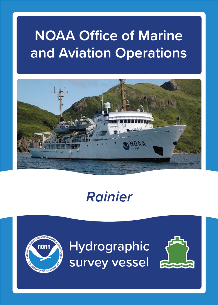
NOAA Ship Rainier, NOAA Office of Marine and Aviation Operations, Hydrographic survey vessel. Image: Photo of NOAA Ship Rainier at sea.
Front
Rainier. This ship maps the ocean to improve maritime commerce and coastal resilience as well as
Back

About

This ship maps the ocean to improve maritime commerce and coastal resilience as well as 
maintain NOAA’s nautical charts.

  • Home port: Newport, OR.
  • Commission date: October, 1968.
  • Length: 231 feet.
  • Areas of operation: Pacific Ocean. 

Fun fact!

This ship’s side-scan sonar collects imagery of the sea floor, which can identify obstructions or wrecks that could be navigational hazards. Learn more about NOAA Ship Rainier

Reuben Lasker

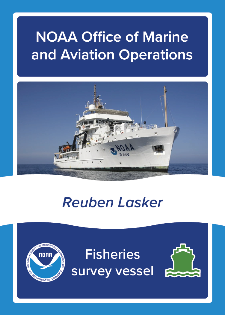
NOAA Ship Reuben Lasker, NOAA Office of Marine and Aviation Operations, Fisheries survey vessel. Image: Photo of NOAA Ship Reuben Lasker at sea.
Front
Reuben Lasker. This ship supports fish, marine mammal, seabird, and turtle surveys in the tropical Pacific Ocean and Alaska. Home port: San Diego, CA. Commission date: May 2, 2014. Length: 208.7 feet. Areas of operation: Pacific Ocean. Fun fact! This ship has a dynamic positioning system to steer along a predetermined trackline and accurately hold the ship in a fixed position. www.noaa.gov/education. www.omao.noaa.gov/learn/marine-operations/ships.
Back

About

This ship supports fish, marine mammal, seabird, and turtle surveys in the tropical Pacific Ocean and Alaska.

  • Home port: San Diego, CA.
  • Commission date: May 2, 2014.
  • Length: 208.7 feet.
  • Areas of operation: Pacific Ocean. 

Fun fact!

This ship has a dynamic positioning system to steer along a predetermined trackline and accurately hold the ship in a fixed position. Learn more about NOAA Ship Reuben Lasker

Ronald H. Brown

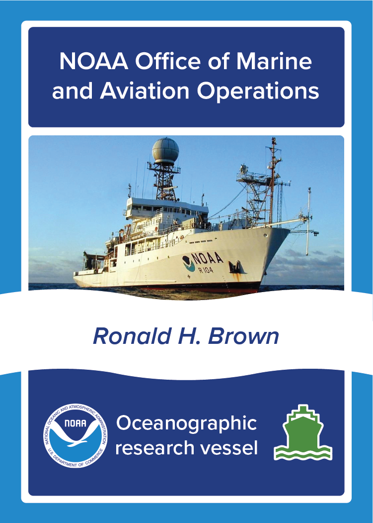
NOAA Ship Ronald H. Brown, NOAA Office of Marine and Aviation Operations, Oceanographic survey vessel. Image: Photo of NOAA Ship Ronald H. Brown at sea.
Front
Reuben Lasker. This ship supports fish, marine mammal, seabird, and turtle surveys in the tropical Pacific Ocean and Alaska. Home port: San Diego, CA. Commission date: May 2, 2014. Length: 208.7 feet. Areas of operation: Pacific Ocean. Fun fact! This ship has a dynamic positioning system to steer along a predetermined trackline and accurately hold the ship in a fixed position. www.noaa.gov/education. www.omao.noaa.gov/learn/marine-operations/ships.
Back

About

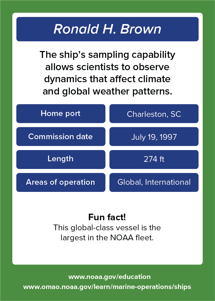
This ship’s sampling capability allows scientists to observe dynamics that affect climate and global weather patterns.

  • Home port: Charleston, SC.
  • Commission date: July 19, 1997.
  • Length: 274 feet.
  • Areas of operation: Global, International. 

Fun fact!

This global-class vessel is the largest in the NOAA fleet. Learn more about NOAA Ship Ronald H. Brown

Thomas Jefferson

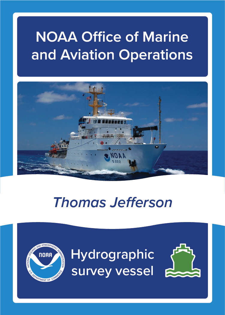
NOAA Ship Thomas Jefferson, NOAA Office of Marine and Aviation Operations, Hydrographic survey vessel. Image: Photo of NOAA Ship Thomas Jefferson at sea.
Front
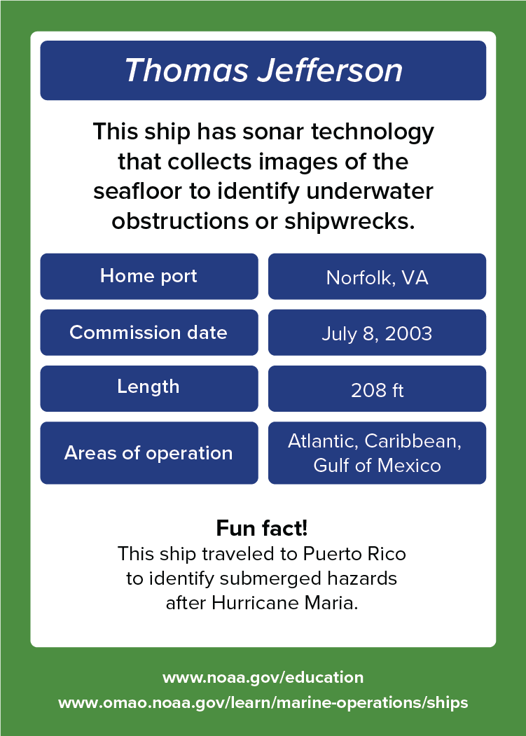
Thomas Jefferson. This ship has sonar technology that collects images of the seafloor to identify underwater obstructions or shipwrecks. Home port: Norfolk, VA. Commission date: July 8, 2003. Length: 208 feet. Areas of operation: Atlantic, Caribbean, Gulf of Mexico. Fun fact! This ship traveled to Puerto Rico to identify submerged hazards after Hurricane Maria. www.noaa.gov/education. www.omao.noaa.gov/learn/marine-operations/ships.
Back

About

This ship has sonar technology that collects images of the seafloor to identify underwater obstructions or shipwrecks.

  • Home port: Norfolk, VA.
  • Commission date: July 8, 2003.
  • Length: 208 feet.
  • Areas of operation: Atlantic, Caribbean, Gulf of Mexico. 

Fun fact!

This ship traveled to Puerto Rico to identify submerged hazards after Hurricane Maria. Learn more about NOAA Ship Thomas Jefferson